


It’s our sincere hope that each of you, our readers, will greatly enjoy and appreciate this article we present about these 4 Rapturous North American Rivers. It was certainly our pleasure to gather the various information for you. May it provide you with both education and increased awareness.
Certainly, these few locations listed herein represent only a very small portion of the wonders found throughout this amazing region of the world. It’s our belief, though, that they serve as excellent representations of the marvels found here. Check out some of our other many articles, as well.
Rio Grande River
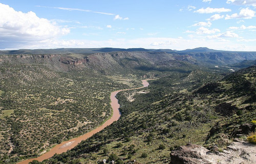
Photo: Andreas F. Borchert
CCL: https://tinyurl.com/4f25epkn
Rio Grande River Facts
- Leading off this article about these 4 Rapturous North American Rivers we present you with the remarkable flow known as the Rio Grande River.
- The short yet descriptive term applied herein serves as the most often employed title for this incredible creation of natural forces. Yet, the marvel does have several other general names. These include the very similar tags Rio Bravo and, appropriately, The Great River.
- Still other alternate monikers exist, as well. These include designations such as Rio Grande del Norte. Most typically used within formal and historical context, this one emphasizes its northern course. The term Rio Bravo Grande also exists, blending two of the appellations.
- The Great River, meanwhile, holds its own special place in history and culture. The flow represents an English translation of its name, sometimes used in literature or informal contexts. These tags reflect its history and the many different cultures that interacted with it.
- Ancient Indigenous Peoples long knew of its existence, of course. Archaeological evidence confirms their presence along its course as far back as around 10,800 BCE. Various tribes inhabited locations along its length at different times throughout history, in fact.
- In more modern times, though, the first confirmed sighting of it by outsiders only occurred in the year 1519. At that time, the famed Spanish explorer Álvar Núñez Cabeza de Vaca, part of an expedition led by Pánfilo de Narváez, and his companions sighted the stunning marvel.
- Today, the stunning Rio Grande River earns fully deserved appreciation for its wonders. In its region, it holds the status of a National Wild and Scenic River. Sadly, however, it’s nevertheless highly vulnerable to the perils of human modification and still ongoing climate change.
CCL: https://tinyurl.com/bdes27an
Rio Grande River Physical Description
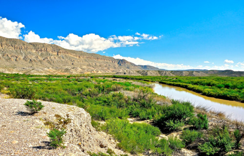
The magnificent Rio Grande River rarely fails to capture the interest and imagination of those who view this natural wonder. It generally impresses the viewer with its splendor and beauty. Indeed, it does so in a wide variety of ways, like many similar features found around the world.
For starters, though, its sheer length certainly qualifies as a point of interest for many. It easily ranks as one of the longest rivers on the continent in which it formed. Though it naturally follows a very winding course, it nevertheless stretches for an impressive length of 1,896 mi (3,051 km).
Overall, it follows a roughly southward path. The upper portions of its course flow through steep, narrow canyons and high desert terrain. As the remarkable river moves into other regions, however, it passes through more arid landscapes, including broad desert valleys and low-lying plains.
Its width also varies significantly, especially in diffferent sections. In the Upper Reaches, this ranges from a mere 30 – 100 ft (9.1 – 30 m). Along the Middle Course, though, this averages roughly 100 – 200 ft (30 – 61 m). And finally, the Lower Course averages about 200 – 500 ft (61 – 152 m) across.
Surprisingly, though, despite its width, the Rio Grande River remains relatively shallow. The Upper Reaches only average 2 – 10 ft (0.61 – 3 m) in this regard. The Middle Course just holds a mean depth of 10 – 20 ft (3 – 6.1 m). And lastly, the Lower Course only averages 10 – 30 ft ( 3- 9.1 m).
Even at its deepest point the river only measures about 60 ft (18.3 m) deep. Taken together, however, these various measurements provide the wonder with an impressive discharge rate. Although this naturally varies, of course, it averages a remarkable 2,403 cu ft/s (68 cu m/s).
CCL: https://tinyurl.com/22y23f9m
Rio Grande River Location, Formation, and Ecology
The gorgeous Rio Grande River Formed in a region of the globe already well known for its extreme abundance of natural marvels. That region therefore likely won’t surprise many of you. That’s because the river formed as part of the equally beautiful continent of North America.
This breathtaking flow of water primarily moves through the United States. There, the river begins its journey in southern Colorado, and flows through New Mexico and into Texas. In the latter region, it also forms the natural border between the United States and the country of Mexico.
The formation of this marvel of Nature’s a direct result of complex geological processes that took place over millions of years. These processes involved tectonic activity, volcanic activity, and erosion, all of which strongly contributed to the river’s current course and characteristics.
The Rio Grande Rift is a major feature that played a crucial role in the formation of the river. The rifting began about 30 million years ago. As the crust stretched and thinned, large blocks of the Earth’s crust subsided, creating a series of basins that would eventually channel water flow.
Volcanic activity along the path of its flow also led to the formation of volcanic mountains and lava flows, which further influenced the mighty river’s path. Over time, the erosion of these volcanic and other surrounding materials by wind, water, and ice inexorably shaped the landscape.
Water from precipitation and melting snow began to flow through the valley, gradually forming a channel. The river initially flowed through a series of interconnected basins. Over time, these filled with sediments, and the river cut through them, creating a steady flow to the Gulf of Mexico.
It supports a diverse and complex ecosystem that varies significantly along its length, from its headwaters its mouth. The river also flows through several separate ecological regions, each with distinctly different plant and animal communities, and faces various environmental challenges.
Its upper regions begin in alpine and sub-alpine areas. Vegetation includes coniferous forests, with a wide variety of trees. It also supports species like the Rio Grande cutthroat trout, as well as various amphibians, birds like the bald eagle, and mammals such as mule deer and many black bears.
The Middle Section of the Rio Grande River contains more riparian zones and desert ecosystems. Here, flora includes species like cottonwood trees, mesquite, cresoste, and cactus. Fauna includes birds, beavers, coyotes, bobcats, and even reptiles like the western diamondback rattlesnake.
The Lower Section, however, contains notably more riparian woodlands and coastal ecosystems. Here, the region’s more characterized by dense riparian woodlands, marshes, and coastal plains near its mouth. At this point, some parts even hve an almost sub-tropical environment.
Mississippi River
Mississippi River Facts
- Next up in this compendium of 4 Rapturous North American Rivers comes the one that’s deeply imbedded in the culture of its land, the Mississippi River.
- The magnificent creation of natural geological forces continues to remain best known around the world by the name of this intriguing tag. But that just forms its english language name. Various local Indigenous Peoples knew the mighty flow by a great variety of other titles.
- The Dakota knew the flow as Haha Wakpa, which roughly translates as river of the falls. The name by which the Choctaw and Chickasaw People knew it, however, was Occochappo, when translated. Meanwhile, the Ojibwe knew this amazing river by the term Messipi.
- Ironically, its english language designation actually derives from an early French language rendering of its title in the native tongue of yet another local tribe. In this case, the Algonguin tongue used the moniker Misi-ziibi. That specific original term aptly meant Great River.
- Regardless of which of these titles, or even still others, it’s called, the wonder stands out among other such features. The first known non-native to view this miracle of Nature bore the name of Hernando de Soto. Records show the Spanish explorer spotted the river in 1542.
- The numerous Nations of Native Americans native to the region knew of it for untold centuries prior to this, though. Innumerable archaeological discoveries of all types prove this beyond doubt. They utilized and depended on its mighty waters for a multitude of reasons.
- Its length remains a matter of which standard one uses. That’s because, as often proves to be the case when measuring the length of rivers, there’s the traditional source and the longest stream source. Using the latter, the Mississippi River is the fourth-longest on earth.
Mississippi River Physical Description
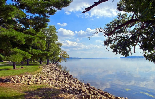
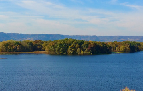
The aptly-named mighty Mississippi River holds an utterly special place of distinction in the hearts, minds, and unique culture of its region. Yet, while wholly deserved, its sheer beauty isn’t the only reason for that wide-reaching appreciation. That’s true since Nature clearly outdid itself here.
This flow also boasts some astounding physical characteristics. Perhaps chief among them, ranks its incredible length. From its immediate point of origin, the river measures an impressive 2,340 mi (3,766 km). Yet, its longest steam source equals a total distance of 3,710 mi (5,971 km).
Despite these mind-numbing statistics, however, it’s surprisiingly quite shallow in depth. At its starting point, it only measures 3 ft (0.9 m) deep! Over the course of its length, though, this naturally varies significantly. But at its deepest, the amazing river’s depth only reaches 200 ft (61 m).
It flows principally southward, and spawns numerous tributaries as it goes. Given this fact, its watersheds drain almost 65% of the country in which it lies. This provides it with another impressive statistic. Due to this situation, it ranks as the thirteenth largest river in terms of discharge.
The very nature of the breathtaking Mississippi River tends to roughly divide it into three distinct sections. These naturally bear the descriptove names of the Upper, Middle, and Lower. Interestingly, its course changed naturally several times throughout its long history due to geological factors.
Mississippi River Location, Formation, and Ecology
The mighty Mississippi River formed in a general region of the globe known throughout the world for its great abundance of geological marvels. In fact, that exact region will no doubt come as no surprise to many of you. That’s because it resides in a specific portion of North America.
There, its main body lies entirely within the confines of the United States. Given the vastness of its watershed, though, a tiny portion of that also appears within two provinces of Canada. The river itself comes to an end in the Mississippi River Delta, where it flows into the Gulf of Mexico.
Evidence indicates that this majestic waterflow formed approximately 70 million years ago. Since then, it’s held many different forms and also flowed in various directions. Its current state largely occurred due to the powerful actions of the Laurentide Ice Sheet of the last ice age.
The melting of the vast quantities of water from this carved out anormous path through the rich sediment that had been deposited. Currently, the river’s base flow comes from Lake Itasca, in Minnesota. Other rivers also flow into it, from their origins, adding their waters to the body.
Not surprisingly, the beautiful Mississippi River additionally serves as home to an incredible array of fauna. A present total of 375 known species of fish actually appear within its confines. That includes such animals as sturgeon, gar, bass, crappie, catfish, northern pike, paddlefish, and walleye.
Many other animals also call its waters home, though. The American Alligator represents the largest of these, but many others join it. Another large reptile present, however, is the equally impressive Alligator Snapping Turtle. Crayfish, aquatic amphibians, and other turtles live there too.
New River
CCL: https://bit.ly/2PiG13j
New River Facts
- Our next choice for inclusion in this gathering of these 4 Rapturous North American Rivers is the beautiful and deceptive feature named the New River.
- This wonder of Nature, cleverly dubbed by this term, actually bears a potentially deceptive name. That’s due to the presence of a certain amount of controversy surrounding its exact age. Some, but not all, geologists consider it one of the oldest rivers on the entire planet.
- Regardless of its status in that regard, however, this amazing work of geological forces still stands out from many similar features in the region. The body of water’s long been serving as a vitally important corridor for the spreading of flora and fauna through the region.
- Several portions of its length also now hold large man-made dams, for hydroelectricity generation. Some of the surrounding ridges, however, also serve as home to uncommon plants. Thankfully, great care has therefore been taken to preserve these many native species.
- Local Native American tribes new of its presence for countless centuries prior to the arrival of European settlers, of course. The first recorded sighting of it by outsiders occurred in 1671. At that time, several members of a fur trading expedition found and explored parts of it.
- Today, local residents greatly enjoy and appreciate its magnificent natural beauty. This further takes many forms. These frequently include such activities as kayaking and rafting. Numerous large, open ledges also dot its length, allowing for the creation of fabulous viewing sites.
- The foundations of the misleading name New River itself remain undetermined with complete certainty. One theory purports that it derives from a word in the language of the local tribes that means new waters. Several differing theories, however, propose other origins.
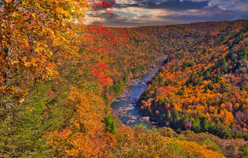
New River Physical Description
The captivating New River generally does exactly that with those individuals discovering it for the first time. The marvel of geology does so for a surprising variety of reasons, however. That’s true since it impresses the viewer with both its pure beauty and quite respectable dimensions.
While it’s certainly not the longest river in the world, this beautiful flow nevertheless boasts a length that’s quite impressive in its own right. Although it does frequently take a somewhat winding course, the overall length of this peaceful flow of water measures out to approximately 360 mi (580 km).
It also stands out for another reason, as well. The direction of its flow further distinguishes it from the many other rivers in its part of the world. That’s because the wonder’s believed to be the only major river in the entire country in which it appears to primarily flow in a northward direction.
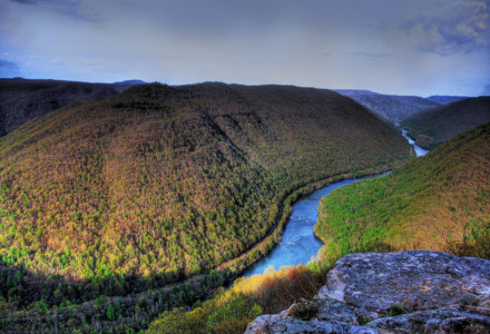
Along its intriguingly wending course, the New River also inexorably cuts its way through numerous gorges. Some of these also have an impressive depth, with the local walls rising as much as 1,500 ft (457.2 m) above the surface of the water. It also boast numerous areas of powerful rapids.
Its depth also varies, in some cases quite extremely. Along most of its course, this characteristic varies, reaching as much as 100 ft (30.5 m). However, in a few sections, this dwindles to no more than a few inches! In areas other than around the rapids, the river typically has a slow, gentle flow.
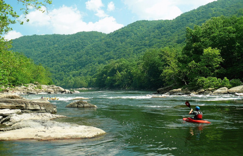
New River Location, Formation, and Ecology
The controversially-named New River formed in a region of the world already quite well known for its abundance of scenic beauty. This region consists of a long-settled portion of North America. More precisely, the natural marvel formed in the southeast portion of the United States.
There, this remarkable flow of water presently finds its presence restricted to a total of just 3 states. These fortunate locations consist of North Carolina, Virginia, and West Virginia. Coincidentally, the meandering path it takes flows through far corners of all three of these of the regions.
This wonder originates in a portion of the Blue Ridge Mountains located in northwestern North Carolina, themselves part of the Appalachian Mountains. The spot from which it flows, the headwaters, in fact, lies only a short distance from the extremely popular resort town of Boone.
Varying estimates place its time of origin to somewhere anywhere between 10 and 360 million years ago. During this time, the ancient Appalachian Mountains continued their slow yet inexorable push upward. This gradually altered the direction of its flow, and thus shortened its length.
The amazing New River also flows through the very heart of the largest block of relatively unfragmented, mid-latitude forest still remaining in the entire world. This setting serves as home to countless plant varieties, including dozens of different species of trees, largely hardwoods.
Perhaps even more impressively, its banks provide a home to a relatively large abundance of flora, both in numbers of species, and sheer volume, too. This plethora of life includes many uncommon forms of cedars, pines, and sedges. Some of these, in fact, appear nowhere else on earth.
Equally impressive, however, stands the fact that fauna at least equally abounds in the region, partly thanks to its presence. Many of these evolved as endemic, while others migrate along its banks. At least 65 species of mammals live in the region, along with nearly 40 species of reptiles.
The bucolic waters of the meserizing New River also boast at least seven varieties of fish, with an abundant population. Some of these also appear nowhere else on earth. Many types of insects and birds, migratory and otherwise, appear in the region, including the majestic Bald Eagle.
Missouri River
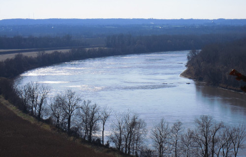
CCL: https://tinyurl.com/33psz7af
Missouri River Facts
- Closing out this compilation of 4 Rapturous North American Rivers is another one steeped in history and tradition in the local culture, the Missouri River.
- This majestic flow of water, created over eons of time, most frequently goes by the somewhat deceptive common name that we’re applying. This wonder does have a few other general titles, though. These tags include the colloquial terms Mighty Mo and Big Muddy.
- However, the beautiful river also holds still other names. These often reflect various historical, geographical, or cultural contexts. Though less known, these still exist within the native tongues of various populations of local Indigenous Peoples, who’ve long known of it.
- The Lakota People call it Mníšoše, which means “The Water of the Big River.” Meanwhile, in the original language of the Hidatsa People, this geological wonder bears the name “Horse River.” Both the Miami and Illinois tribes, though, referred to it as Peki-tan-oui.
- Archaeological evidence indicates that early humans likely first encountered this marvel of Nature somewhere between roughly 12,000-10,000 years ago. At the end of the last glacial period, large migrations took place, many apparently occuring along its winding path.
- European explorers did not discover the mighty flow until much later, however. The first documented sighting of it by a non-native took place in late June,1673. At that time, the well known French-Canadian explorering team of Louis Jolliet and Jacques Marquette sighted it.
- Today, the mighty Missouri River holds many distinctions. Among those comes the fact that it appears on the list of the seven great rivers of the world. It also stands out as the longest of all rivers in the nation in which it lies. Several areas along its length now enjoy special protection.
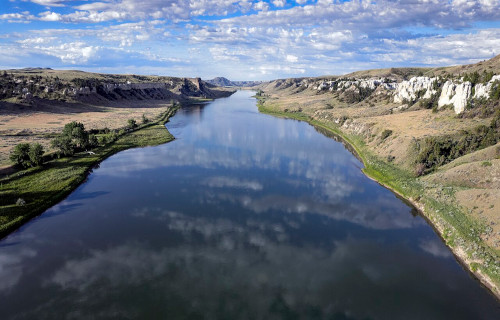
CCL: https://tinyurl.com/bdes27an
Missouri River Physical Description
The indescribably impressive Missouri River rarely fails to mesmerize those who view this marvelous work of Nature for the first time. Those who do, though, often find themselves hard-pressed to choose which trait most amazes them. That’s because it’s both beautiful and extensive.
Though certainly not the longest river found on the planet, it’s nonetheless lengthy enough to merit its own respect in this regard. The mighty flow extends for a measured length of approximately 2,341 mi (3,767 km). Along its passage, the wonder incredibly also flows roughly both east and south.
For purposes of clarification, most experts currently divide the river into three distinct regions. The first of these also understandably bears the fitting name of the Upper Missouri. This portion of the river begins in mountainous terrain, characterized by rugged landscapes and narrow valleys.
As it ponderously moves along, the moniker of the second division likewise follows the same pattern of naming. The Middle Missouri flows into the area of the nation called the Great Plains. As it does so, though, it broadens and meanders through wide valleys surrounded by prairies.
The final stretch of the fantastic river naturally holds the title of Lower Missouri. Here, the river flows into yet another of the seven great rivers of the world, the Mississippi River. Approaching that confluence, it passes through fertile agricultural regions and more developed areas.
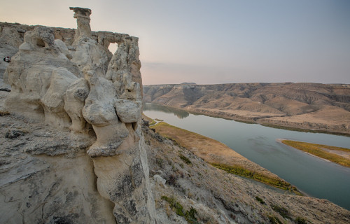
The Missouri River also traverses a remarkable and highly diverse range of landscapes, including mountains, plains, and valleys. Its basin covers roughly 529,350 sq mi (1,371,000 sq km). This actually equals about one-sixth of the area of the continental part of the nation it resides in!
Historically, the river additionally carried an enormous amount of sediment, therefore earning it the nickname “Big Muddy.” However, the construction of several dams later reduced that. Despite these, its flow nevertheless still varies seasonally, being heavily influenced by snowmelt.
CCL: https://tinyurl.com/22y23f9m
Missouri River Location, Formation, and Ecology
The amazing Missouri River formed in a region of the globe already well known for its impressive abundance of varied geological marvels. The exact location of this beautiful flow therefore likely won’t surprise many readers. Nature created it as part of what’s now North America.
Within that greater region, however, the entirety of its length actually lies completely within the national borders of the United States. Its admittedly rather circuitous course takes it from the approximate northwestern part of the country to slightly the eastern-central section of the country.
The awesome body of water originates in Montana. From there, it flows generally southeast, cutting through the central part of the nation. Along with that state, it passes through or along the borders of six others, including, North Dakota, South Dakota, Nebraska, Iowa, Kansas, and Missouri.
The formation of this work of Nature occurred due to a powerful combination of both complex geological and hydrological processes. This formative process also took place over the passage of many millions of years. In fact, evidence indiactes it dates back to nearly 70 million years ago.
At that time, a large inland sea covered the area that it now claims. This shallow sea gradually retreated as tectonic activity raised the land. The uplift of the Rocky Mountains and other ranges also provided a source of sediment and created a gradient that influenced the direction of flow.
As the majestic mountains rose, though, erosion processes began to irresistably wear them down, with streams and rivers carrying sediments eastward. The eroded material from the Rockies and other areas contributed to the development of extensive alluvial plains and river systems.
During what scientists call the Pleistocene epoch, roughly 2.6 million to 11,700 years ago, multiple glaciation events also played a significant role in shaping the landscape. Glaciers advanced and retreated over the region, carving out valleys and altering the flow patterns of rivers.
The melting of these provided a substantial amount of water, contributing to the river’s flow and helped define its current course. The modern course, however, established itself as the waters cut through the sedimentary plains. Its path additionally shifts over time due to natural processes.
This wonder supports a diverse and complex ecosystem that varies along its length, including a range of habitats from its headwaters to its confluence with the Mississippi River. Its ecology’s naturally shaped by factors such as climate, geology, hydrology, and even human activities.
In its upper reaches, the impressive river flows through numerous montane and riparian habitats, alike, all characterized by cold, clear water. This region further supports a broad variety of cold-water fish species, and the surrounding landscapes include many forests and alpine meadows.
Meanwhile, the middle section of the great Missouri River features large sandbars, islands, and braided channels, which are important for nesting birds and other wildlife. Some of these include the American white pelican, bald eagle, great blue heron, and various ducks and geese.
Near its confluence with the Mississippi River, though, it flows through a notably much more temperate region with a number of mixed deciduous forests, wetlands, and urbanized areas. Yet, it still hosts many other flora and fauna. A few examples include beaver, deer, muskrats, and otters.
4 Rapturous North American Rivers
We hope that each of you thoroughly enjoyed reading, and hopefully learning something from, this article we’ve written about these 4 Rapturous North American Rivers. It’s also our fervent hope that doing so has left you with either a new or renewed appreciation for such wonders of Nature.
Unfortunately, many other such features around the world now find themselves facing threats to their continued existence in an undamaged state. Many of those dangers, in fact, stem from the actions of mankind. We must each do everything that we can to protect and preserve them all.
Check out our other articles on 5 Geological Wonders of Wyoming, Africa’s Many Geological Masterpieces, 5 Sensational Salamanders, Fabulous Fungi Around the Globe