


CCL: https://bit.ly/3hka4mj
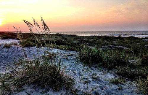
We sincerely hope that you enjoy this article on 5 Incredible North American Islands. Technically, of course, countless islands have official association with the continent, but remain quite physically distant. Officially, this even includes such locations as Greenland and the Bahamas. However, for the sake of this particular article, we are dealing only with river islands or those in close proximity to the mainland.
Avery Island

CCL: https://bit.ly/1p2b8Ke
Avery Island Facts
- The first of our 5 Incredible North American Islands is the only river island on the list, the gorgeous Avery Island.
- Firstly, it is a truly unique geological site with a decidedly spicy story to tell. That’s because the entire inland portion of the small island actually conceals an enormous salt dome.
- Quite understandably, the location has been used for salt mining for many centuries. Not surprisingly, the Native Americans also used it for that purpose long before European settlers arrived.
- But in the 1830’s, private owners purchased the small island. The family that still owns it established a factory there in 1868. That’s due to the fact that the unique climate proved excellent for growing certain peppers.
- Further, the company uses those same peppers, even today. These are used to produce its signature product, known as Tabasco sauce. Therefore, this tiny piece of land serves as the home of the well-known hot sauce.
- Finally, as if its other natural assets weren’t enough, workers also discovered oil on Avery Island in 1942.
CCL: https://bit.ly/1p2b8Ke
Avery Island Physical Description
Most notably, marvelous Avery Island does not ranks as particularly large in size. In fact, it measures about 3 mi (4.8 km) in length, and about 2.5 mi (4 km) in width. It therefore has a total area of roughly 7.5 sq mi (19.2 sq km).
In addition, the great majority of the geography of the small island formed relatively flat. To further illustrate this amazing fact, the highest point only measures 163 ft (50 m) above sea level.
Furthermore, the fascinating Avery Island itself remains surrounded by several different types of habitat common to the area. These consist of salt marshes, bayous, and also vast sections of swamp.
CCL: https://bit.ly/1p2b8Ke
Avery Island Location, Formation, and Ecology
First of all, the unique Avery Island forms part of Iberia Parrish, Louisiana, United States, in North America. Yet more precisely, it sits roughly 3 mi (4.8 km) inland from Vermilion Bay. This bay in turn empties into the Gulf of Mexico.
Also, the island formed from evaporite salt deposits beneath the Mississippi River Delta. Avery Island actually forms one of five such salt domes known to exist near the Louisiana Gulf Coast.
The amazing location also serves as home to an incredibly diverse, not to mention beautiful, ecosystem. In addition to the native flora and fauna, numerous species have been brought to the island.
The owners also created a private sanctuary for numerous animals from around the world. As early as 1895, they formed a bird sanctuary for the endangered egret. Today, the island is home to an extensive population during their migration.
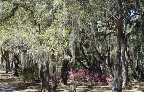
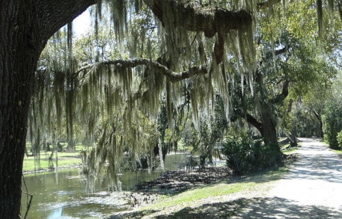
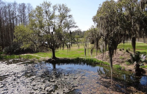
Kiawah Island
CCL: http://bit.ly/2LOffYQ
Kiawah Island Facts
- Appearing next among our 5 Incredible North American Islands is the absolutely astounding site known as Kiawah Island.
- Firstly, the tiny but quite magnificent location possesses multiple types of environments. The island virtually forms a rather remarkable geological, biological, and botanical sampler.
- Further, the impressive island primarily serves as as a resort area. This includes numerous gated beaches and golf courses. But the number of permanent inhabitants hovers at only around 1,600.
- Additionally, the dazzling small island received its name in honor of the local Kiawah Indians. Members of the native American tribe originally led European settlers to the site in 1670.
- Finally, two locations on Kiawah Island make the list of the United States National Register of Historic Places. Beachwalker County Park also sits on the western end of the small island.
CCL: https://bit.ly/3qZdT3x
Kiawah Island Physical Description
Perhaps most notably, the terrain of Kiawah Island formed predominantly flat. In this, it remains much like many islands in the region. However, the total rough area of this astounding beauty only equals 13.4 sq mi (34.8 sq km).
It also boasts numerous small, naturally occurring waterways and ponds, found in abundance there. Just look at how they dot the island. These also account for roughly 18.4% of the surface area of the small island.
Further, narrow but beautiful beaches also line the edges of the highly elongated island. Yet Nature did not stop there. Numerous small areas of marsh also appear on this marvelous site.
CCL: https://bit.ly/2UxL7uE
Kiawah Island Location and Ecology
First of all, while astonishingly beautiful, Kiawah Island constitutes a small barrier island. In addition, this marvel of Nature lies situated on the eastern shores of the United States, in the Atlantic Ocean.
Furthermore, the geological marvel formed roughly 25 mi (49 km) southwest of Charleston, S. Carolina.
Also, a relatively small but still dense area of forest occupies the approximate center of the island. Officials named this a protected area. While comparatively small, this forest still supports a relatively prosperous ecosystem.
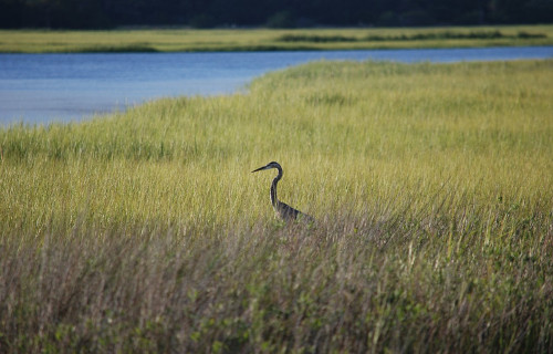
Finally, Bald Eagles and bobcats remain among the animals found within the confines of this protected zone.
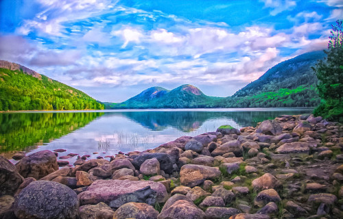
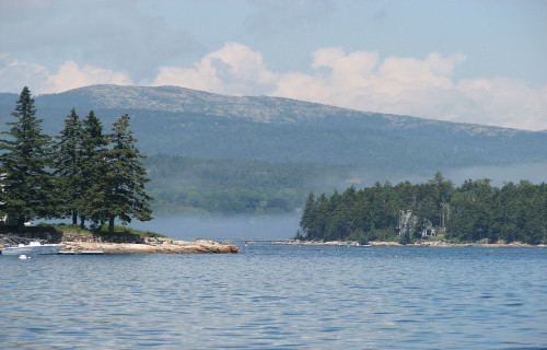
Mount Desert Island
CCL: https://bit.ly/3hka4mj
Mount Desert Island Facts
- The third of our 5 Incredible North American Islands is the awesome location with the completely deceptive name of Mount Desert Island.
- Mount Desert Island ranks as the 6th largest island in the contiguous United States. It also holds the distinction of being the second largest island on the U.S. Eastern seaboard.
- This geological gem also boasts the Acadia National Park. Its permanent population numbers less than 11,000 individuals, yet more than 2.5 million tourists visit the island annually.
- Additionally, a French expedition leader in 1604 gave the island its current name. However, the indigenous Native American people always called the island Pemetic, which meant the sloping land.
- History further indicates habitation going back more than 6,000 years. According to archaeological records, the Wabanaki people moved between the coast and inland according to the seasons.
CCL: https://bit.ly/3dNz1EF
Mount Desert Island Physical Description
Firstly, the beautiful Mount Desert Island covers an area of roughly 108 sq mi (280 sq km). It also has an irregular outline. In addition, Cadillac Mountain stands as the highest point on the island. It boasts a height of 1,528 ft (466 m).
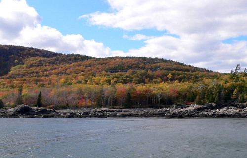
It’s the natural splendor that draws the most attention, however, and deservedly so. Large portions of the island teem with stunning forests, mainly consisting of deciduous trees.
A large fire in 1947 cleared half the island of most of its coniferous trees, allowing other species to take hold. Much of the forest now consists of aspen, birch, and maple. Parts of the island still teem with wildlife, including deer, raccoon, lynx, and muskrats.
The native North American Beaver population was hunted to extinction but has since been repopulated. Several well-known summer colonies have been constructed there, due to the great natural beauty.
CCL: https://bit.ly/3dPu8e7
Mount Desert Island Geology and History
Geological evidence shows that Mount Desert Island originally formed around 550 million years ago. The earliest known formation on the island, a seafloor mud deposit, formed during the Cambrian Period.
Powerful plate tectonics later caused the massive formation to fold, thrust, and then lift above sea level. However, a second foundation, composed mainly of silt and sand, subsequently deposited later.
Lastly, a third foundation, composed primarily of volcanic ash and magma, formed even later. The retreat of the Laurentide Ice Sheet during the last ice age also exposed huge deposits of granite.
Finally, one of the most noteworthy geological features of the island is known as Bubble Rock. The retreating glacier left this enormous glacial erratic behind and also left it perched precariously on the side of a mountain.
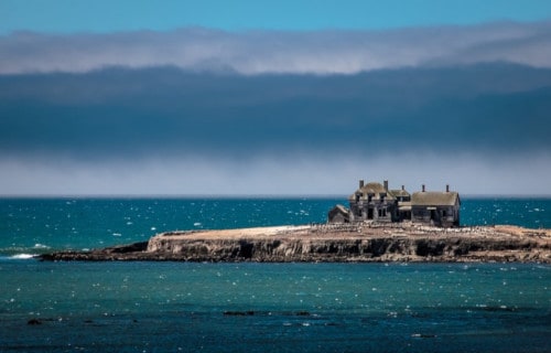
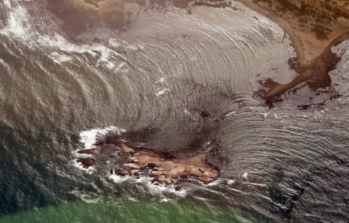
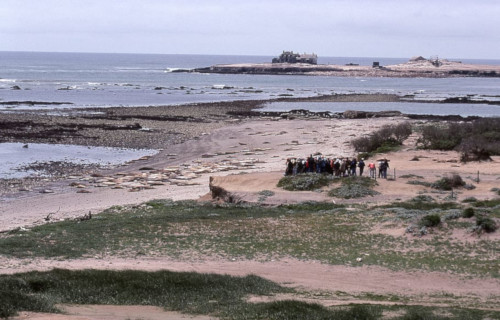
New Year’s Island
CCL: http://bit.ly/2RcCTlc
New Year’s Island Facts
- Our next entry on this listing of 5 Incredible North American Islands is the smallest of them all, the highly unusual New Year’s Island.
- This rather tiny island actually represents only one of several islands in the world bearing the name on New Year’s Island
- Despite its extremely tiny and seemingly barren surface area, it plays a surprisingly important role in its region
- The original name, in Spanish, is Ano Nuevo Island. Fortunately, it also now forms part of the Ano Nuevo State Reserve
- As part of ongoing efforts to protect the small island, access to it remains restricted to members of approved research teams
- In addition, a restoration project was begun in 2010, partly to restore native plants to the site.
CCL: http://bit.ly/2xLZ0ap
New Year’s Island Description and Geology
Regardless of its great ecological importance, the surprising New Year’s Island has an extremely tiny total area.
This relatively vital, yet little-known, location also only measures about 392,000 sq ft, or 9 acres (3.6 ha).
Up until the 18th century, the island was still a peninsula. Over time, a channel formed, separating it from the mainland.
A combination of shale and deposits from ancient dunes primarily makes up the composition of the location.
Its exact shape changes slightly rather often, as waves pound its comparatively soft shoreline, especially during strong storms.
New Year’s Island Location and Ecological Importance
The ecologically important New Year’s Island also sits just off the northern coast of California, in the United States, in North America.
To ensure its protection, the island is also managed under an agreement with the California Department of Parks and Recreation.
This island has also long served as a vital breeding ground for many animals, some of which ranks as Endangered.
These include northern elephant seals, the endangered Steller Sea Lion, and several species of important seabirds.
In addition, due to the presence of so many seals and sea lions, Great White Sharks rather commonly frequent the surrounding area.
Prince Edward Island
Prince Edward Island Facts
- And last, but absolutely not least in any sense of the term, in this article about 5 Incredible North American Islands, is Prince Edward Island.
- Firstly, the breathtakingly beautiful island ranks a true geological marvel. It also remains renowned for its lush agricultural land, as well as its great swathes of pastoral land.
- In addition, the magnificent island represents one of the oldest settlements in the country. The location bears the name of Prince Edward (1767-1820), the father of Queen Victoria.
- Rather unsurprisingly, agriculture forms the principal economy of the island. Further, this remarkable island alone produces roughly 25% of all potatoes grown in the country it forms a part of.
- Finally, it also serves as an important location for numerous other industries. These include tourism, fishing, aerospace, bio-science, and especially renewable energy research and development.
CCL: https://bit.ly/1ryPA8o
Prince Edward Island Geology
The province of which Prince Edward Island forms the central component consists of the main island and also 231 minor constituent islands. Altogether this grouping comprises a total land area of about 2,195 sq mi (5,685 sq km). The main island itself measures roughly 2,170 sq mi (5,620 sq km).
Further, the island formed between 250-300 million years ago, during the Permian period. Freshwater streams deposited enormous quantities of gravel, sand, and silt into the region now popular as the Gulf of Saint Lawrence.
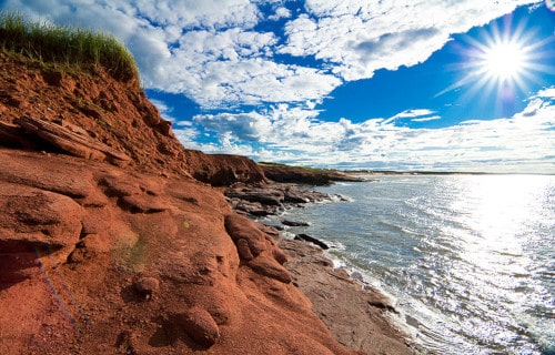
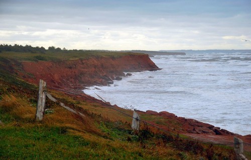
Also, much of the bedrock of the island principally consists of red sandstone. Prior to the enormous glacial melting which occurred during the last ice age, the island was connected to the mainland by a small strip of land.
Prince Edward Island Geography
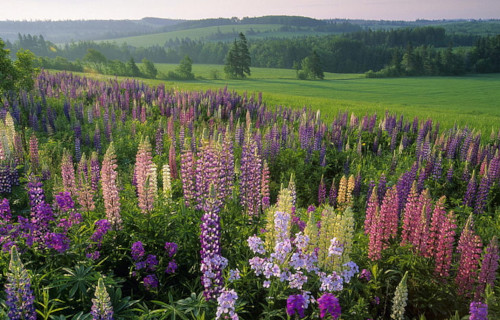
The island sits north of the Nova Scotia Peninsula, within the Gulf of Saint Lawrence. The landscape of the island remains primarily pastoral, and famous for the unique combination of thickly wooded regions, gently rolling hills, beaches of reddish-white sand, numerous coves, and the ever-present red soil.
Also, present along the shoreline are numerous saltwater marshes and red sandstone cliffs. The northern shore of the island holds numerous and extensive dune fields. In Basin Head cape, the unique properties of the white silica sand actually generate a singing sound when walked on.
CCL: https://bit.ly/1p2b8Ke
Prince Edward Island Location and Climate
Firstly, Prince Edward Island and its associated numerous small islands and islets comprise one of the provinces of Canada, in North America.
In general, the climate remains relatively mild for its latitudinal position. During the months of July and August, the usual high temperature is 73F (23C) with occasional highs of as much as 86F (30C). During the coldest months of winter, the average highs are 26F (-3C).
The island receives an annual rainfall average of about 33.7 in (855 mm), as well as a yearly snowfall average of roughly 11.2 in (285 cm). Spring storms are plentiful, due to the constant clash between weather fronts from both the Arctic and the Atlantic weather patterns.
CCL: http://bit.ly/2LOffYQ
We truly hope that you have enjoyed this article about 5 Incredible North American Islands. Of course, these 5 are only the tiniest sampling of the many hundreds of islands in the region, let alone in the entire world. Each seems to have its own distinctive personality, to those who love islands. But, sadly, many of them face a variety of problems. These include climate change and invasive species, just to name a few. Their comparatively tiny size, though part of their charm, also serves as a weakness to such factors. Let us do all we can to preserve them for our future.
Check out our other articles on 9 Bewildering African Plants, 4 Fantastically Fascinating Fungi, Earth’s Geothermal Marvels, Breathtaking Asian Species, 10 Remarkable Rare Cetaceans