

Mount Vesuvius Facts
- This creation of time and geological processes remains best known by the english language name of Mount Vesuvius. In Italian, however, the marvel holds the very similar name of Vesuvio. The only alternate names it bears are simply translations into other languages.
- Regardless of the title one chooses to use for it, though, it stands out from other, similar features around the world. It’s erupted, usually violently, many times in known history. Its destruction of Pompei still ranks as one of the greatest such disasters to ever occur.
- Due to its eruptive nature, it’s considered one of the most dangerous volcanoes in the world. That’s partly because of that tendency, to be certain. That’s greatly augmented, however, by the fact that approximately 3 million people live close enough to it to be directly affected.
- Despite all these pertinent facts, however, Mount Vesuvius remains one of the most popular tourist attractions in its part of the world. That’s largely due to the presence of the ruins of the city of Pompei, as mentioned previously. About 2.5 million visitors flock there yearly.
- Because of this astonishing popularity, wholly regardless of potential dangers, the local government declared the site a National Park in 1995! The summit itself is now open to visitors. Park authorities maintain a network of paths around the area, in addition to a spiral walkway.
Related Articles
Mount Vesuvius Physical Description
The breathtaking Mount Vesuvius immediately captures the attention of all those lucky enough to visit the volcanic site. It does so partly because of the knowledge of its history, to be certain. Yet the wonder also typically impresses most visitors due to its sheer physical dimensions as well.
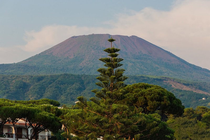
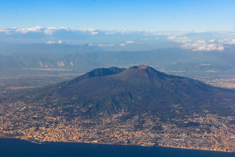
The mountain as it exists today qualifies as what’s known by experts as a humpbacked peak. This primarily consists of a large cone, circled by a very steep rim. This rim in turn forms part of the summit caldera of the volcano. Once much higher, an earlier eruption lowered this significantly.
The magnificent mountain also boasts some undeniably remarkable physical measurements. The cone itself currently has a height equaling 4,203 ft (1,281 m) above sea level. These additionally sit more than 1,300 ft (400 m) above the 3.1 mi (5 km) long valley, named Atrio di Cavallo, nearby.
The cone of the captivating Mount Vesuvius itself also shows an extra feature that distinguishes it. At roughly 1,968 ft (600 m) up its slope, a large, semi-circular ridge appears. Known as Mount Somma, itself, this feature girdles the cone on the northern side, and rises to 3,714 ft (1,132 m).
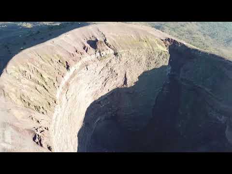
Between Mount Somma and the cone lies a structure that’s now named the Valle del Gigante. At the summit of the cone is a large crater measuring roughly 1,000 feet (305 m) deep. That structure is also about 2,000 ft (610 m) across. That formed during an eruption that occurred in 1944.
Mount Vesuvius Location, Formation, and History
The stunning volcanic formation known around the world as Mount Vesuvius formed in a part of the world already well known for its abundance of natural marvels. In fact, its precise location likely doesn’t surprise anyone. That’s true since it formed in a part of the continent of Europe.
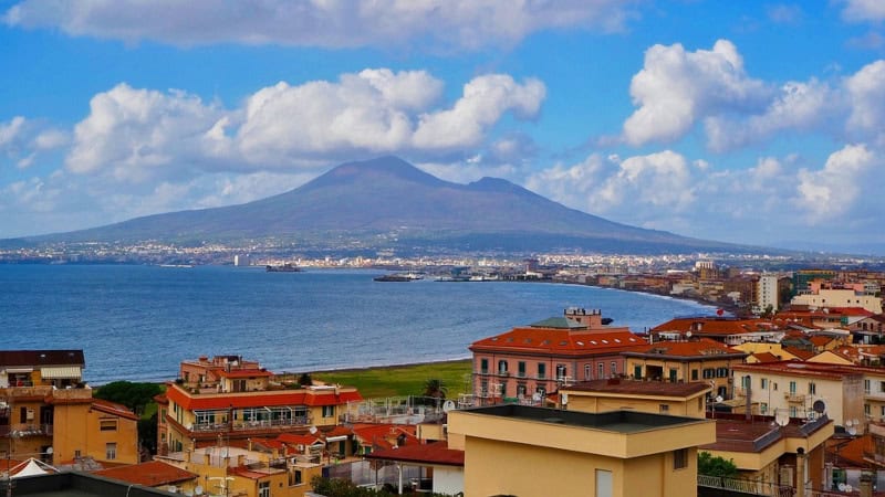
There, this stunning masterpiece of geological processes lies within the borders of what’s now the country of Italy. More exactly, though, its exact location places it within the Gulf of Naples. That puts the mountain inside the region comprising the administrative region known as Campania.
The amazing site represents a type of what’s called a stratovolcano. It originated due to the collision of two tectonic plates, the Eurasian and the African. The latter plate moved under the other, and its water-soaked sediments lowered the melting point of the upper mantle, which pushed up.
Given that magma remains less dense than the surrounding solid rock, pressure inexorably pushed that upward. As often happens in such situations, this eventually found a weak spot at the surface of the Earth. There, it eventually broke through, thus forming the volcano in its original form.
Geological evidence indicates that Mount Vesuvius first formed during its initial eruptive event around 25,000 years ago. Between that time and around 3,800 years ago, it experienced numerous powerful events. Subsequent to that, it entered a long phase of numerous smaller eruptions.
It’s unquestionably best known, however, for its destructive eruption in AD 79. Miraculously, one recorded eyewitness account adds to the scientific evidence. The massive blast ejected ash and stone up to 21 mi (33 km) into the air. Pompei and Herculaneum were both utterly destroyed.
Features Sharing Its Region

Check out our other articles on 4 Phenomenal Philippine’s Reptiles, Zebra Spider, Cumberland Falls, Eastern Gray Squirrel, Appalachian Avens, Bluespotted Ribbontail Ray, Weka, Mugger Crocodile