

Rio Grande River Facts
- The short yet descriptive term of Rio Grande River serves as the most often employed title for this incredible creation of natural forces. Yet, the marvel does have several other general names. These include the very similar tags Rio Bravo and, appropriately, The Great River.
- Still other alternate monikers exist, as well. These include designations such as Rio Grande del Norte. Most typically used within formal and historical context, this one emphasizes its northern course. The term Rio Bravo Grande also exists, blending two of the appellations.
- The Great River, meanwhile, holds its own special place in history and culture. The flow represents an English translation of its name, sometimes used in literature or informal contexts. These tags reflect its history and the many different cultures that interacted with it.
- Ancient Indigenous Peoples long knew of its existence, of course. Archaeological evidence confirms their presence along its course as far back as around 10,800 BCE. Various tribes inhabited locations along its length at different times throughout history, in fact.
- In more modern times, though, the first confirmed sighting of it by outsiders only occurred in the year 1519. At that time, the famed Spanish explorer Álvar Núñez Cabeza de Vaca, part of an expedition led by Pánfilo de Narváez, and his companions sighted the stunning marvel.
- Today, the stunning Rio Grande River earns fully deserved appreciation for its wonders. In its region, it holds the status of a National Wild and Scenic River. Sadly, however, it’s nevertheless highly vulnerable to the perils of human modification and still ongoing climate change.
Related Articles
Rio Grande River Physical Description
The magnificent Rio Grande River rarely fails to capture the interest and imagination of those who view this natural wonder. It generally impresses the viewer with its splendor and beauty. Indeed, it does so in a wide variety of ways, like many similar features found around the world.
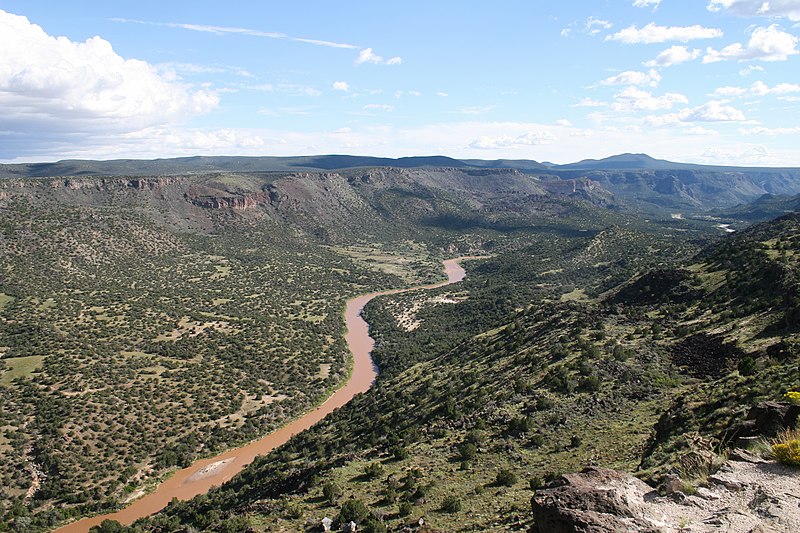
For starters, though, its sheer length certainly qualifies as a point of interest for many. It easily ranks as one of the longest rivers on the continent in which it formed. Though it naturally follows a very winding course, it nevertheless stretches for an impressive length of 1,896 mi (3,051 km).
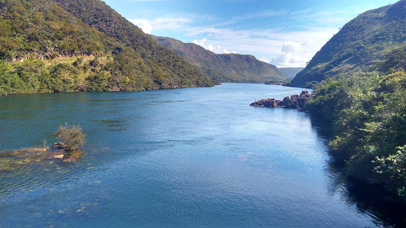
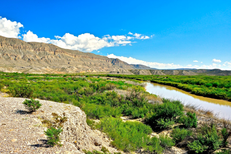
Overall, it follows a roughly southward path. The upper portions of its course flow through steep, narrow canyons and high desert terrain. As the remarkable river moves into other regions, however, it passes through more arid landscapes, including broad desert valleys and low-lying plains.
Its width also varies significantly, especially in diffferent sections. In the Upper Reaches, this ranges from a mere 30 – 100 ft (9.1 – 30 m). Along the Middle Course, though, this averages roughly 100 – 200 ft (30 – 61 m). And finally, the Lower Course averages about 200 – 500 ft (61 – 152 m) across.
Surprisingly, though, despite its width, the Rio Grande River remains relatively shallow. The Upper Reaches only average 2 – 10 ft (0.61 – 3 m) in this regard. The Middle Course just holds a mean depth of 10 – 20 ft (3 – 6.1 m). And lastly, the Lower Course only averages 10 – 30 ft ( 3- 9.1 m).
Even at its deepest point the river only measures about 60 ft (18.3 m) deep. Taken together, however, these various measurements provide the wonder with an impressive discharge rate. Although this naturally varies, of course, it averages a remarkable 2,403 cu ft/s (68 cu m/s).
Rio Grande River Location, Formation, and Ecology
The gorgeous Rio Grande River Formed in a region of the globe already well known for its extreme abundance of natural marvels. That region therefore likely won’t surprise many of you. That’s because the river formed as part of the equally beautiful continent of North America.
This breathtaking flow of water primarily moves through the United States. There, the river begins its journey in southern Colorado, and flows through New Mexico and into Texas. In the latter region, it also forms the natural border between the United States and the country of Mexico.
The formation of this marvel of Nature’s a direct result of complex geological processes that took place over millions of years. These processes involved tectonic activity, volcanic activity, and erosion, all of which strongly contributed to the river’s current course and characteristics.
The Rio Grande Rift is a major feature that played a crucial role in the formation of the river. The rifting began about 30 million years ago. As the crust stretched and thinned, large blocks of the Earth’s crust subsided, creating a series of basins that would eventually channel water flow.
Volcanic activity along the path of its flow also led to the formation of volcanic mountains and lava flows, which further influenced the mighty river’s path. Over time, the erosion of these volcanic and other surrounding materials by wind, water, and ice inexorably shaped the landscape.
Water from precipitation and melting snow began to flow through the valley, gradually forming a channel. The river initially flowed through a series of interconnected basins. Over time, these filled with sediments, and the river cut through them, creating a steady flow to the Gulf of Mexico.
It supports a diverse and complex ecosystem that varies significantly along its length, from its headwaters its mouth. The river also flows through several separate ecological regions, each with distinctly different plant and animal communities, and faces various environmental challenges.
Its upper regions begin in alpine and sub-alpine areas. Vegetation includes coniferous forests, with a wide variety of trees. It also supports species like the Rio Grande cutthroat trout, as well as various amphibians, birds like the bald eagle, and mammals such as mule deer and many black bears.
The Middle Section of the Rio Grande River contains more riparian zones and desert ecosystems. Here, flora includes species like cottonwood trees, mesquite, cresoste, and cactus. Fauna includes birds, beavers, coyotes, bobcats, and even reptiles like the western diamondback rattlesnake.
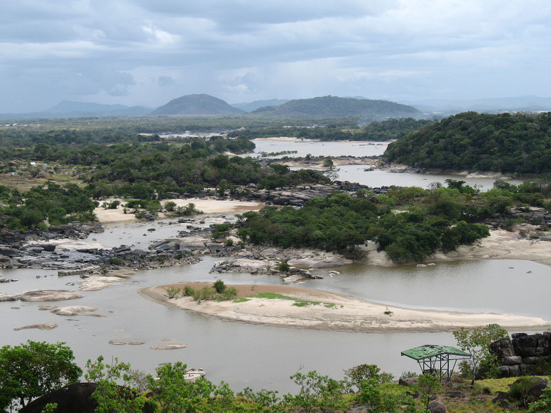
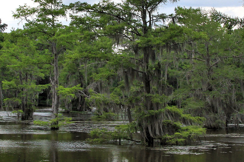
The Lower Section, however, contains notably more riparian woodlands and coastal ecosystems. Here, the region’s more characterized by dense riparian woodlands, marshes, and coastal plains near its mouth. At this point, some parts even hve an almost sub-tropical environment.

Features Sharing Its Region
Check out our other articles on 4 Amazing Australian Spiders, Japanese Hare, Mount Jade, Lehua Tree, Jack Jumper Ant, Southern Stingray, Indian Vulture, Texas Alligator Lizard, Little Auk