


CCL: https://tinyurl.com/2s4apsss
It’s our hope that each of you, our readers, will thoroughly enjoy and appreciate this article we present about 5 of Earth’s Magnificent Mountain Ranges. It was certainly our great pleasure to gather the information for you. May it provide you with both education and increased awareness.
As awesome as they are, the peaks listed herein still represent only a portion of the marvels found throughout our remarkable world. It’s our belief, though, that they serve as excellent representations of the features awaiting the explorer. Check out some of our many other articles, as well.
Tatra Mountains
CCL: https://tinyurl.com/22y23f9m
Tatra Mountains Facts
- Starting off this article about 5 of Earth’s Magnificent Mountain Ranges we give you the gorgeous chain best known as the Tatra Mountains.
- This surprisngly simple term now serves as the most frequently used name for these amazing constructions of geological processes. It’s not the only title they hold, though. They also hold several other, even shorter one’s. These include the similar terms Tatrasa or Tatra.
- Those, however, merely represent the english language appellations for the marvels of Nature and natural forces. In some of the many other languages common to the region in which they sit, they hold others. Two tongues native to the area call it the similar name of Tatry.
- Regardless of which of these epithets one chooses to employ when speaking of it, the formation remains an impressive structure. Together, they also constitute a subset of a more extensive range of peaks. Collectively, though, these qualify as the highest group in the range.
- Fortunately, the magnificent Tatra Mountains now enjoy a very special status. The set of stunning mountains forms a natural border between the two countries in whose language it’s known as Tatry. Both of those nations now recognize the region as a special National Park.
- This status creates a unique situation, though. Each country created a Tatra National Park containing that specific portion of the range on their side. Due to this, UNESCO recognized the extraordinary two sites jointly as what forms a single, transboundary biosphere reserve.

CCL: https://tinyurl.com/33psz7af
Tatra Mountains Physical Description
The mesmerizing Tatra Mountains never fail to capture the attention of those individuals fortunate enough to visit the site. The geological wonder does so for a surprising variety of reasons, though. That’s true since they boast both truly remarkable beauty and impressive physical statistics.
Intriguingly, these breathtaking marvels extend along the earth in an almost perfectly straight line. That further stretches for approximately 35 mi (56.3 km). Its width naturally varies along its course, though. But, at its widest point the formation measures roughly 12 mi (19.3 km) across.
Overall, this majestic work of Nature and geological processes contains a total area equaling about 303 sq mi (785 sq km). Of that, however, roughly 77.7% lies within the borders of one country. The remaining 22.3% therefore falls inside the national boundaries of the other nation sharing it.
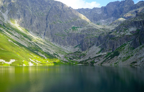
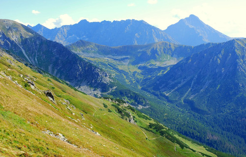
The breathtaking Tatra Mountains remain deseervedly renowned for the ruggedness of the terrain, and rightly so. Each peak juts strongly upward. Most possess a covering of snow at the top for much of the year. The majority also have numerous sharply created ridges, both lateral and forked.
A large percentage of individual sites in both nations also boast substantial measurements. The highest point in one country, named Gerlachovský štít, possesses an altitude equaling 8,710 ft (2,655 m). Yet, the tallest site located in the other country, named Rysy, stands 8,200 ft (2,499 m) tall.
CCL: https://tinyurl.com/33psz7af
Tatra Mountains Location, Formation, and Ecology
Nature and time created the stunning Tatra Mountains in a region of the earth’s surface already renowned for its great abundance of geological wonders. That precise setting therefore comes as no surprise to anyone. It formed as part of what’s now the very beautiful continent of Europe.
More specifically, its creation placed the chain in the approximate central region of the landmass. There, these amazing structures straddle the borders of the countries of Poland and Slovakia. They themselves, however, also form a special component of the even larger Carpathian Mountains.
Interestingly, the origins of these astonishing features represent a combination of both relatively recent and ancient. That’s because the underlying structure, an outcropping of granite formed during the Mesozoic Period. That places its beginings between 250 – 100 million years ago.
Above that, however, numerous other layers subsequently formed later. Between about 65 – 1.8 million years in the past, igneous, metamorphic, and sedimentary rocks later formed. The latter type, though, now form the basis of the surface, including limestone, dolomite, and sandstone.
Despite their generally rugged nature, however, the hauntingly magical Tatra Mountains still possess a fully thriving ecosystem. Luckily, their placement puts them in the general temperate zone of the continent. This allows for moderate levels of precipitation throughout the entire year.
More than 3,000 species of plants, fungi, and lichens reside on the slopes present here. These vary with altitudes, though. Due to the extreme abundance of flora, fauna also does well here. Those include numerous mammals, as well as a few reptile and amphibians, plus fish and insects.
Himalayas
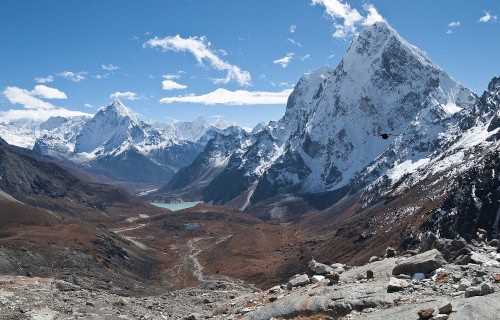
Photo: Vyacheslav Argenberg
CCL: https://tinyurl.com/5954phb3
Himalayas Facts
- Now appearing in this compilation of 5 of Earth’s Magnificent Mountain Ranges comes the world renowned marvel named the Himalayas.
- This magnificent creation of Nature and geological processes remains best known to the majority of the world by the appellation we’re using here. It does have a few more general titles by which it’s known, though. Those include Great Himalayas and Snowy Mountains.
- These few choices, however, represent only differing english language versions of their designation. The marvelous feature naturally also holds still more monikers in other languages. Those include Himavan, Parvata Raja, Himal, Gang Rinpoche, and Qomolangma Feng.
- This mountain range was never discovered in the traditional sense. That’s true since ancient man inhabited the region long before the rise of actual civilizations. In fact, archaeological evidence indicates a human presence in the region stretching back tens of thousands of years.
- In more modern times, though, after the rise of formal cultures, European explorers eventually became the first outsiders to view this breathtaking formation during the colonial period. British surveyors became the first in the early 1800s to begin detailed cartographic work.
- Fortunately, the various governments of the nations within whose borders the Himalayas lie recognize their significance. Due to this cognizance, the range of mountains now enjoys at least partial protection. Their sheer size and scope renders complete protection impossible.
- What does exist, however, constitutes various national parks, wildlife sanctuaries, and conservation initiatives spread across those countries. Many of these form UNESCO World Heritage Sites, in addition to numerous local biosphere reserves and Nature Reserves.
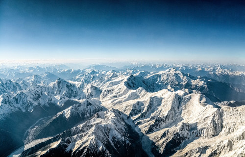
CCL: https://tinyurl.com/btdm3sjj
Himalayas Physical Description
The Himalayas never fail to leave those who encounter them breathless with wonder. In their entirety, their span befuddles many with its scope. In length, they extend 1,500 mi (2,400 km). Their width ranges from 124 – 248 mi (200 – 400 km), with an area of 230,000 sq mi (595,000 sq km).
However, they’re also composed of four clearly distinct main ranges. The so-named Outer Himalayas remains the lowest of these in terms of height. Their vertical reach ranges from around 1,969 – 3,937 ft (600 – 1,200 m). It’s also primarily composed of soft sandstone, clay, and boulders.
Next comes that portion of the marvel of geology called the Lesser Himalayas. In terms of altitude, these peaks extend upward to points that range from roughly 11,483 – 14,764 ft (3,500 – 4,500 m). This section of the greater area also features a unique blending of rugged terrain with fertile valleys.
The next composite section of this range bears the apt title of the Greater Himalayas. It forms both the tallest and most continuous part of the marvel. Here, the tops of the individual peaks averages an incredible 19, 685 ft (6,000 m). The earth’s tallest land peak lies here, at 29,032 ft (8,849 m).
The fourth and final primary component of the Himalayas bears the slightly different honorific of the Trans-Himalayas. This itself also contains three smaller ranges, named Karakoram, Ladakh, and Zaskar. These each principally contain notably barren, cold desert regions with very high passes.
Not to be outdone, however, Nature also blessed this extraordinary wonder with still more separat natural wonders. Here, a mind-numbing total of over 15,000 glaciers appear! Between them many of these collectively form the sources of the Ganga, Indus, Brahmaputra, Yamuna, and Mekong rivers.
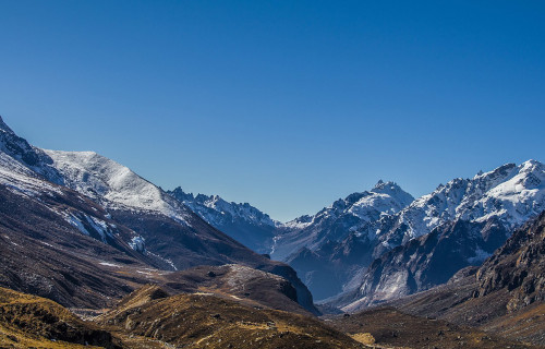
CCL: https://tinyurl.com/mrx5uknb
Himalayas Location, Formation, and Ecology
The beautiful Himalayas formed in a region of the world already well known for its extreme abundance of natural wonders. That location therefore comes as no surprise to most people who learn of it. That’s true since natural processes created it as part of the stunning continent of Asia.
These peaks form a huge mountain system along the northern boundary of the Indian subcontinent, acting as a natural barrier between South Asia and the Tibetan Plateau. Their reach also extends through the span of the five separate countries of India, Nepal, Bhutan, China, and Pakistan.
The formation of this majestic beauty remains one of the most dramatic events in Earth’s geological history. Around 200 million years ago, a vast ocean called the Tethys Sea lay between two giant landmasses. Science now gives those the names of the Indian Plate and the European Plate.
About 120 million years ago, the Indian Plate broke off from Gondwana and began moving north at a relatively rapid rate. Around 50–55 million years ago, the Indian Plate collided with the Eurasian Plate. The ocean floor between compressed, folded, and uplifted, forming the first ranges.
Yet, Nature continues this process even today. The Indian Plate continues to push into Eurasia at the rate of roughly 2 in (5 cm) per year. Due to this motion, the range continues to rise at a rate of about 0.4 in (1 cm) yearly. It also causes frequent earthquakes in the region, due to tectonic stresses.
Despite the picture people have of the Himalayas, though, the local ecology represents one of the richest on the entire planet. That’s understandably been inexorably shaped over vast spans of time by its unique combination of extreme altitudes, widely varying climates, and differing landscapes.
As the elevation increases, the native environment changes dramatically. In the foothills, which extend up to a height of roughly 4,921 ft (1,500 m), subtropical broadleaf forests appear, including sal, teak, and bamboo. In many local valleys, rich areas of human agriculture frequently abounds.
Meanwhile, from 4,921 – 9,843 ft (1,500 – 3,000 m) temperate forest of oak, rhododendron, pine, cedar, and chestnut thrive. From 9,843 – 14,764 ft (3,000 – 4,500 m) coniferous forests and alpine meadows abound. Between this and 19,685 ft (6,000 m) alpine shrubs, mosses, and lichens live.
A large number of fauna of various types also thrive in locations up to the higher reaches. These include a number of flagship species, such as the Snow Leopard and Red Panda. Along with these, other creatures like the Himalayan tahr, yak, musk deer, and the Himalayan monal also live.
Appalachian Mountains
CCL: https://tinyurl.com/2s4apsss
Appalachian Mountains Facts
- Our next choice to appear on this list of 5 of Earth’s Magnificent Mountain Ranges is the fabulous feature named the Appalachian Mountains.
- Today, this truly breathtaking mountain range almost always goes by the lengthy term that’s being applied to it here. Up until the late 19th century, however, a competing title existed. That’s because many at that time referred to the marvel as the Allegheny Mountains.
- Understandably, the local Indigenous Peoples held different appellations for the range in their various native tongues, though. Among the Cherokee, for example, a select portion of the feature bore the moniker of Shaconage. Other tribes held still other names for it.
- Native Americans long knew of the existence of this natural wonder, of course. Yet, it’s believed the first sighting of it by a non-native occurred somewhere between the years 1539 – 1540. That occurred due to the actions of the Spanish explorer Álvar Núñez Cabeza de Vaca.
- During an earlier expedition, in 1528, somewhat to the south of the range, he encountered a native village. His group translated the name of the tribe as Apalachee. Over time, however, that specific term became synonymous with both the group and the immediate region.
- Fortunately, the undeniably majestic beauty of the entire Appalachian Mountains enjoys a measure of protection from the depredations of man. That’s partly due to the existence of an enormous number of federally protected regions. These exist along its entire length.
- Amazingly, an astonishing total of six National Parks appear along the expanse of this geological marvel. An additional eight national forests also dot its length, along with two national wildlife refuges. Great care is taken to maintain the natural state of these areas.
- Yet, it’s also known for one more astounding feature. Because of the extraordinary length of the range, and its extreme natural beauty, an astounding walking path was created. Known as the Appalachian Trail, this stunning feature stretches for an astounding 2,175 mi (3,500 km).
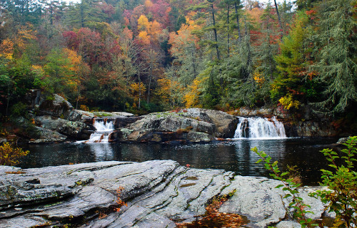
CCL: https://tinyurl.com/22y23f9m
Appalachian Mountains Physical Description
This mind-boggling formation almost immediately captivates those individuals fortunate enough to encounter it for the first time. Yet it does so for a wide combination of reasons. That holds true since it’s not only possessed of great beauty, the site also boasts truly incredible dimensions.
Most experts divide the magnificent mountain range into three clear subdivisions. Each of these sections holds both features similar to the others, as well as some distinct to itself. This allows for at least some context when discussing its qualities, given the vast scale of its massive size.
The most northern section roughly begins in the province of Newfoundland and Labrador, in Canada. From there, though, it extends itself to the Hudson River. Within this greater extent, however, numerous individual features clearly stand out in terms of their impressive stature.
Withn the Canadian portion of this particular section, multiple peaks exceed 4,000 ft (1,219 m) in height. Many others also reach at least 2,700 ft (823 m). In its southern parts, however, several reach or even exceed elevations of 5,000 ft (1,524 m). One attains a height of 6,288 ft (1,917 m).
Meanwhile, the central section of the captivating range roughly reaches from the Hudson River to the state of West Virginia. This stretch contains its own wonders. These include the stunning New River. Yet ot also obasts other marvels to delight the eye of the fortunate visitor or resident.
Subsections of the greater range also exist in this area, including the Allegheny Plateau and the Taconic Mountains. The impressive Great Appalachian Valley, itself a true wonder of Nature, also appears here. The stunning Blue Ridge Mountains, another amazing subset, also begin there.
The southern section of the Appalachian Mountains completes its expansive length. This portion reaches from the deceptively-named New River in Pennsylvania, to northern Alabama. Along its course, though, yet more marvels await, including other mountains of 2,700 ft (823 m) or more.
This portion also holds some of the greatest natural wonders. The magnificent Mt. Mitchell lies within this region of the range. Being the highest point east of the Mississippi, it reaches 6,684 ft (2,037 m). Others include such features as Linville Falls and Sliding Rock, both in North Carolina.
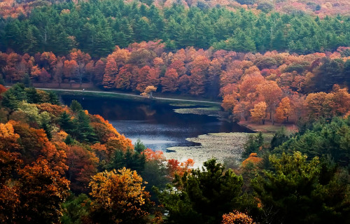
Photo: John McTarnaghan
CCL: https://tinyurl.com/22y23f9m
Appalachian Mountains Location, Formation, and Ecology
The unquestionably awe-inspiring Appalachian Mountains formed in a region of the globe already renowned for its abundance of geological wonders. The location of that area won’t surprise many, though. That’s because it formed in a lovely portion of the continent of North America.
Though one end of the range lies inside Canada, the majority of its expanse runs through the United States. It further resides in the approximate eastern section of the continent. Within the United States, it extends from Maine in the north, to the northern part of the state of Alabama.
The origins of this marvelous work of geological forces actually lie far back in the earth’s distant past. That’s true since this irresitible mountain range began its formation over 1 billion years ago. That makes this amazing natural formation one of the oldest known such in the entire world.
Its birth originally, and primarily, occurred due to the inexorable collision of tectonic plates. Volcanic activity subsequently followed, though much later. The majority of that process occurred around 200 million years ago. Evidence places the last eruption at over 50 million years ago.
The mind-blowing beauty of the Appalachian Mountains further boast a strongly thriving ecology. In fact, the range is considered by most, experts and enthusiasts alike to stand as one of the most biodiverse regions on the entire continent. Species of all kinds thus abound within its confines.
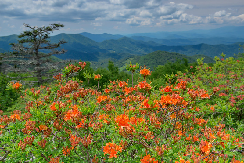
Much of its extent still holds an extensive cover of beautiful forested regions. These woodlands contain a variety of tree types, of course. Deciduous and evergreen species alike proliferate in abundance. Many other plants also appear, including the Flame Azalea, which lives nowhere else.
Innumerable species of both animals and insects also appear here. Mammals of all sizes, from squirrels to deer and black bear thrive in the region. Birds of all kinds additionally spend their lives here. The reptiles present include the large and dangerous Eastern Diamondback Rattlesnake.
Alps
Alps Facts
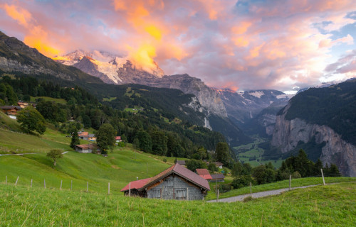
- Next up in this compendium of 5 of Earth’s Magnificent Mountain Ranges we present you with the amazing creation of Nature knowns imply as the Alps.
- The deceptively short term now represents the most frequently used name for this breathtaking creation of time and natural forces. Yet, it also has several other, if less often employed titles by which it’s known. Those consist of the similar tags Alpen, Alpi, and Alpe.
- Ancient, prehistoric humans knew of the existence of this geological masterpiece long before our modern era. Indeed, archaeological evidence indicates that prehistoric peoples knew of it as far back as 10,000 – 5,000 BCE. By aroud 500 BCE, Celtic tribes inhabited the region.
- Many notable events in the history of the continent in modern times took place within their confines. Hannibal notably crossed the range with a herd of elephants, and the Romans even had settlements in the region. Napolean also crossed one of the passes with a large army.
- Fortunately, the stunning Alps now enjoys a certain degree of protection from the depredations of man. That comes in the form of a mix of national parks, nature reserves, and international agreements. Several UNESCO Biosphere Reserves also appear in multiple parts of the range.
- Nevertheless, the impressive collection of mountains faces a variety of environmental, human, and climate-related threats. Habitat loss and biodiversity decline now occur, due to a variety of human-related factors. Climate change also threatens it, including the retreat of glaciers.
CCL: https://tinyurl.com/mrx5uknb
Alps Physical Description
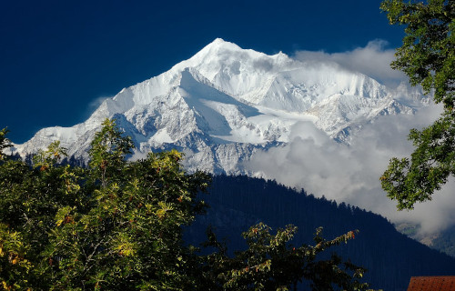
The remarkable Alps never fail to immediately capture the attention and interest of those individuals fortunate enough to encounter them Unlike similar features around the world, however, they do not do so due to their grandeur alone. That’s because they also boast impressive stature.
Stretching roughly from west to east, the collective range extends for a total distance of about 750 mi (1,200 km). It also has an extremely distinctive width, ranging from approximately 75 – 155 mi (120 – 250 km). Taken together, these give it an amazing total area of 77,000 sq mi (200,000 sq km).
As a general principle, most experts divide the greater range into three separate main sections. The aptly-named Central Alps remains the shortest of the component parts of the larger grouping. In total, this subsection of this awesome wonder of Nature stretches for 185 – 250 mi (300 – 400 km).
Meanwhile, the equally properly-named section known as the Western Alps ranks as the second-longest of these three parts of this true wonder of geological formation. Being moderately greater in length than the central region, this subdivision extends for about 280 -310 mi (450 – 500 km).
The final subsection of the Alps holds the appellation Eastern Alps. This portion, the lengthiest, sprawls for a total of 435 mi (700 km). Intriguingly, it’s also divided into three smaller groupings. These hold the tags Northern Limestone Alps, Central Eastern Alps, and Southern Limestone Alps.
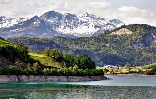
Individual spectacular features also appear within the confines of these mountains. Several of the highest peaks in its part of the continent formed here. Numerous glaciers reside at the higher altitudes. Deep U-shaped valleys, and countless steep, rugged ridges also dominate the entire range.
CCL: https://tinyurl.com/44ka7ja6
Alps Location, Formation, and Ecology
Nature formed the mesmerizing Alps in a region of the surface of the earth already well known for its grat abundance of similar natural marvels. Exactly where it lies, therefore, likely won’t surprise a great many people. That’s true since geological activities created this true wonder as part of Europe.
Forming a crescent-shaped arc, they extend from the Mediterranean Sea near Nice, France, and run all the way to the nation of Slovenia. Along that route, they wend through a total of eight countries. Those are France, Monaco, Italy, Switzerland, Liechtenstein, Germany, Austria, and Slovenia.
About 300 million years ago, the surrounding region comprised a flat area with an ancient mountain chain, which later slowly eroded. Over a vast span of time, a comparatively shallow sea, known to science as the Tethys Ocean, covered the entire area, depositing numerous layers of sediments.
Then plate tectonics also came into play, aiding its creation. Around 65 million years ago, the African Plate began moving northward and collided with the Eurasian Plate. This caused the closure of the ocean and pushed up the sedimentary rocks, folding and faulting them into huge mountain chains.
The collision caused intense compression, folding rocks into complex structures, named nappe formations and thrust faults. Metamorphic rocks, such as various types of gneiss, schist, and marble uplifted from deep in the Earth. Large granite intrusions also eventually formed in some regions.
Subsequently, during the Ice Age, which lasted from approximately 2.5 million to 11,700 years ago, enormous glaciers carved the landscape, creating the multiple distinctive U-shaped valleys, sharp peaks, and cirques. Many present-day lakes also originated via the erosion of these many glaciers.
Experts divide the Alps into five altitudinal zones in regards to vegetation. The Colline zone reaches up to 2,600 ft (800 m), with deciduous forests, vineyards, orchards, and agriculture in valleys. The Montane zone, at 2,600 – 4,900 ft (800 – 1,500 m) holds mixed forests with beech, fir, and spruce.
At 4,900 – 6,600 ft (1,500 – 2,000 m) sits the Subalpine Zone, with coniferous forests of larch, pine, and spruce. The Alpine zone lies at 6,600 – 9,800 ft (2,000 – 3,000 m), with meadows, grasses, and hardy flowers. The Nival zone, above 9,800 ft (3,000 m) is mostly bare, with mosses and lichens.
Wildlife also abounds at the lower altitudes. That includes large mammals, like Chamois and red deer. Small mammals like marmots, alpine hare, and stoats thrive here too. Birds appear in quantity, along with a few reptiles and amphibians. A high diversity of butterflies and beetles appears too.
Rocky Mountains
CCL: https://tinyurl.com/2uwyub7v
Rocky Mountains Facts
- Finishing off this article about 5 of Earth’s Magnificent Mountain Ranges we present to you the breathtaking wonder named the Rocky Mountains.
- The fitting name yu find used here represents the most often used english language title for these amazing works of Nature. They also hold other, if less well-known, terms by which they’re known. These include The Rockies and Backbone of the Continent, among others.
- Yet, these majestic peaks also bore other monikers long before their discovery by outside explorers. In the languages of various groups of Indigenous Peoples of the area, these included such appellations as Mó’ȯhtávo’ome with the Cheyenne and Nisnáánánis for the Arapaho.
- Ancient humans inhabited this stunning range for countless ages prior to their notice by others. Archaeological evidence indicates that the Clovis and Folsom cultures appeared here between 14,000 – 12,000 years ago. That placed them there even before the end of the last ice age.
- In modern times, though, the first recorded descriptions of their grandeur due to the efforts of early Spanish explorers. Juan de Oñate made the first definitive spotting of them, in 1598. It’s possible, however, that Francisco Vázquez de Coronado saw them earlier, in 1540 – 1541.
- Thankfully, the beauty and historical significance of the Rocky Mountains led to their receiving certain protections by the governments of the nations in which they appear. This comes in the form of the formation of numerous National Parks, National Forests, and Wilderness Areas.
- Nevertheless, these mind-boggling features still faces multiple threats to their pristine state. Those consist of a mix of environmental, ecological, and human-driven dangers. These include glacier loss, snowpack decline, wildfires, shifts in ecosystems, and habitat fragmentation.
Rocky Mountains Physical Description
The aptly-named Rocky Mountains virtually never fail to capture the immediate attention and interest of individuals fortunate enough to visit them. The range does so, though, for more than one reason. That’s true since the formation boasts not just raw beauty, but also multiple features.
In total length, this true marvel of geology stretches for an incredible total of approximately 3,000 mi (4,800 km). Given their presence, location, and size, they also form the backbone of the continent on which they reside. Yet, it must be pointed out that they’re comprised of several chains.
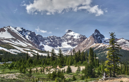
The Canadian Rockies remains largely characterized by the presence of a vast number of rugged, jagged peaks. Often being steep and pointed, many of these bear a regular cap of snow. Some of these exceed 11,500 ft (3,500 m) in height. Valleys also appear, with U-shaped forms and steep cliffs.
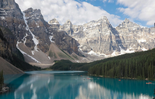
Numerous glaciers and ice fields also dot the region. Glacial erosion created multiple cirques, moraines, and glacial lakes, often with brilliant turquoise waters. Countless pristine lakes also reside in this range, along with several major rivers whose origins stem from the glaciers on their heights.
Meanwhile, the Northern Rockies have an impressive number of individual mountains as well. These, however, generally tend to be lower than those of the Canadian part. Altitudes here range from 6,500 – 10,000 ft (2,000 – 3,000 m). These also usually have less jagged, more rounded peaks.
Though some of the valleys present display the U-shaped form typical of the Northern Rockies, the majority possess a more V-shaped structure. Glacial activity also appears here, though to a lesser extent. Small glacial lakes do exist, often high in the mountains, typically being fewer and smaller.
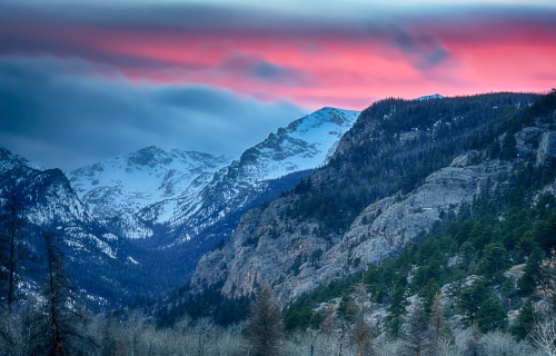
The Central Rockies possess their own distinct nature. This part of the grouping largely consists of notably high, extremely rugged summits and broad ridges. Many of these separate features exceed 13,000 ft (4,000 m) in height. That tallest of these, Mount Elbert, stands 14,400 ft (4,401 m).
Here, the valleys usually form broad intermontane basins, The terrain remains mainly quite steep, though often less so than the Canadian section. With the glaciers gone, cirques, moraines, glacial valleys, and alpine lakes nonetheless still appear. Many major rivers also have their beginnings here.
The final component of the awesome Rocky Mountains bears the name Southern Rockies. Here, the peaks generally rank as lower than other sections. Most of these range from around 10,000 – 14,000 ft (3,000 – 4,300 m) in height, with a mix of rugged peaks, broad ridges, and volcanic formations.
Its valleys tend to be wide intermontane basins, with several high plateaus and river valleys. Most peaks also tend to be more rounded than other areas of the greater range. Glacial remnants include the same cirques, small alpine lakes, and moraines. Snowfields still persist in the highest regions.
Rocky Mountains Location, Formation, and Ecology
The mesmerizing Rocky Mountains formed in a part of the world already extremely well known for its remarkable abundance of natural beauty. Exactly where they reside therefore probably won’t come as a surprise to many people who learn of it. They appear on the continent of North America.
There, geological forces of Nature created them in the approximate western portion of the continent. Within that greater landmass, though, their great length actually stretches through two separate countries. They lie within the national borders of both the United States and Canada.
In Canada, this wonder of geology falls within the confines of the two provinces of Alberta and British Columbia. Within the boundaries of the United States, however, it passes through a total of six states. Its length passes through Montana, Idaho, Wyoming, Colorado, Utah, and New Mexico.
This wonder formed through a combination of tectonic activity, uplift, and erosion over a vast span of time. The majority of it formed during the Laramide Orogeny, roughly 70–40 million years ago. This affected a broad area of western North America, far inland from the plate boundary.
Tectonic forces also helped with their formation. That occurred due to the subduction of the Farallon Plate beneath the North American Plate. Instead of forming typical coastal mountains, this created uplift far inland. Between 2.6 million to 11,700 years ago, glacial activity further modified it.
Throughout the entirety of this time, however, other factors inexorably molded it, too. Flowing rivers, wind, and frost also shaped the range into the rugged peaks, high ridges, and intermontane basins we see today. Even today, it continues to uplift, though erosion gradually wears it down.
Due to its length and range of altitudes, the Rocky Mountains understandably hosts several distinct biomes. The foothills extend from 3,000 – 6,000 ft (900 – 1,800 m). Here, grasslands, shrubs, and ponderosa pine dominates. Wildlife present includes deer, coyotes, pronghorn, and rabbits.
At heights from 6,000 – 9,000 ft (1,800 – 2,700 m), though, montane forests rule, dominated by Douglas fir, ponderosa pine, and lodgepole pine. Meadows with wildflowers also appear. Local fauna abounds, including such creatures as lynx, snowshoe hare, wolverine, and owls, just to name a few.
Then the Alpine zone manifests a clear change in this pattern of verdure. This area largely consists of harsh, treeless tundra. Most vegetation consists of only low shrubs, grasses, mosses, and lichens. Here, species such as mountain goats, pikas, marmots, and ptarmigan form the large majority.
CCL: https://tinyurl.com/22y23f9m
5 of Earth’s Magnificent Mountain Ranges
We hope that each of you thoroughly enjoyed reading, and hopefully learning from, this article we’ve written about 5 of Earth’s Magnificent Mountain Ranges. It’s also our hope that doing so has left you with either a new or renewed appreciation for such magnificent wonders of Nature.
Unfortunately, many other such features around the world now find themselves facing threats to their continued existence in an undamaged state. Many of those dangers, in fact, stem from the ongoing actions of mankind. We must do all we can to protect and preserve them all.
Check out our other articles on 5 Incredible Pacific Ocean Rays, Earth’s 7 Mightiest Rivers, 4 Fabulous Geological Features of Texas, The Mighty Tornado, 5 Fantastic Fauna of Tunisia