

Deception Island Facts
- The unusual title of Deception Island serves as the name of this fascinating creation of time and geological forces. That term speaks to the apparent safety provided by what seems to be a relatively safe harbor. That’s not always the case, though, thus the common title.
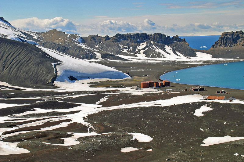
- This spectacular work of Nature actually forms the caldera of an active volcano! The intermittent activity of that occasionally creates havoc at the site. In 1967 and 1969, such activity severely damaged local scientific stations. It once held a whaling station, but no longer.
- It’s also something of a source of ongoing confusion in international politics. That’s because the issue of who possesses control of the island remains unsettled. Over the years, various countries attempted to assert their rule. For the moment, no single state has prevailed.
- Due to the nature of its location, this natural marvel remained undiscovered by the outside world until 1820. In January of that year, two British sealers reported spotting it. The first person to visit it was an American sealer named Nathaniel Palmer, the following November.
- Currently, the remarkable Deception Island remains under the binding authority of an international agreement. That’s comprised of what’s known as the Antarctic Treaty System. That designation became official in the year 2005. It places the site in a most unusual situation.
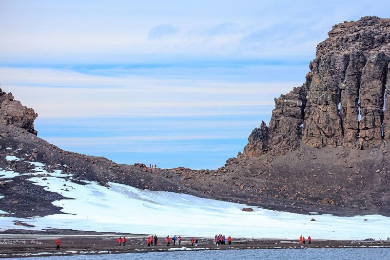
- Despite the occasional dangers posed by its sporadic volcanic activity, the location still serves as something of a tourist destination. Over 15,000 individuals visit the site annually. Two countries, Argentina and Spain, also operate research stations there during the summer.
Related Articles
Deception Island Physical Description
The extremely unusual Deception Island intrigues many of the people who learn of it. The site does this, however, due to several reasons, not just a single one. While it’s certainly no tropical getaway destination, the location nevertheless boasts its own brand of appeal for the curious visitor.
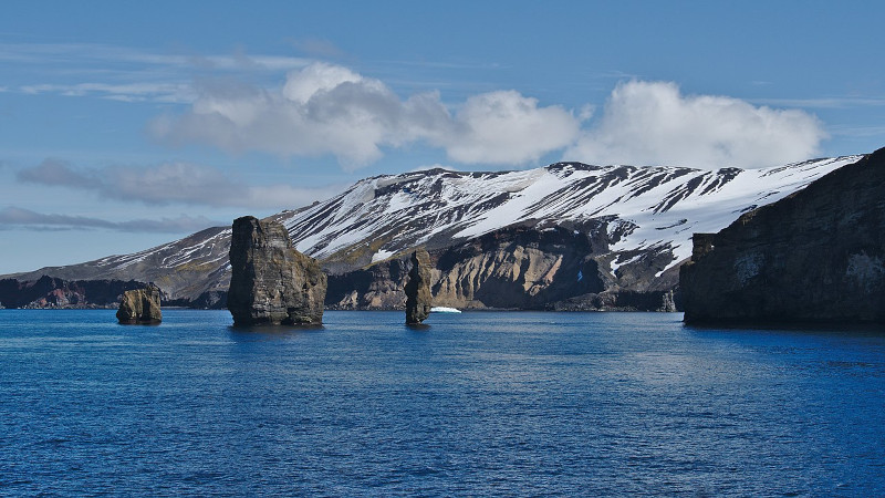
This intriguing wonder of Nature has a highly unique combination of patterns to its shape. While its outer boundaries aren’t perfectly so, it has an approximate circular yet horseshoe shape. At its widest point, the location also possesses a diameter measuring roughly 9.3 mi (15 km).
This wonder itself also contains two mountains of respectable heights, in relation to its size. On the eastern side, Mount Pond stands roughly 1,768 ft (539 m) above sea level. Meanwhile, on the western portion of the island sits Mount Kirkwood. Its height measures approximately 1,483 ft (452 m).
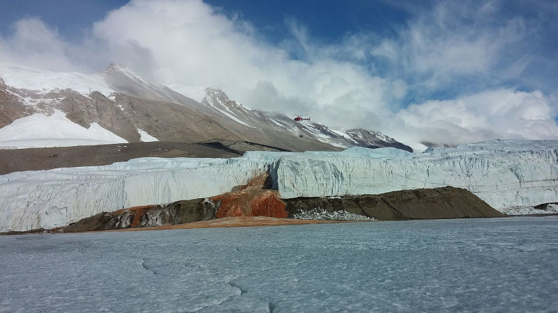
Amazingly, the site holds yet more wonders. That’s due to the remarkable fact that just over half of the area of the island remains covered by glaciers. These are almost 33 ft (10m) thick in some places. The same sections of the formation also contains ice covered pyroclasts and moraines.
Yet it’s perhaps the central portion of Deception Island that draws the most attention from its occasional visitor. That’s due to the fact that the sea flooded the section long ago. The region now represents a relatively large, open bay. This part of the site bears the name of Port Foster.
This feature itself holds bragging rights to some impressive statistics. It’s roughly 6.2 mi (10 km) in length, and 4.3 mi (7 km) in width. Yet it has a very narrow entrance that’s only 1,640 ft (500 m) wide. This feature itself also holds a distinctive name, in this case that of Neptune’s Bellows.
Deception Island Location, Formation, and Ecosystem
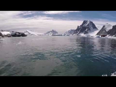
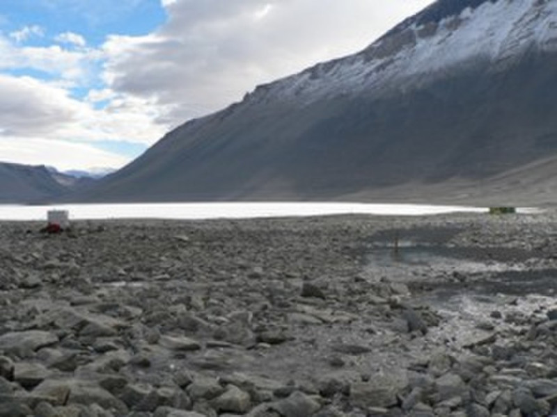
The remarkable Deception Island formed in a region of the world well known for its extraordinary abundance of stark beauty. That’s because this marvel of geological processes formed within the area of the globe known as Antarctica. That makes it an extremely remote location, indeed.
This fabulous volcanic formation further comprises part of the group of natural bodies collectively named the South Shetland Islands. This places the island very close to the Antarctic Peninsula. Within that greater region, though, it sits completely within an area known as the Bransfield Strait.
This island itself, however, repesents only a very small part of the story. What we view as the site in truth is only the exposed part of an active shield volcano. That awesome feature itself measures 18.6 mi (30 km) in diameter. That’s a truly astounding claim to fame for this stunning natural site.
It also continues to remain unknown to geologists exactly when the volcano itself came into existence. Researchers do know, however, the general period when it acquired the form now known to us. The caldera apparently collapsed somewhere roughly between 10,300 – 5,980 years ago.
The intriguing Deception Island, as fully befits its name, contains a deceptively sucessful ecosystem. It actually holds several widely varying microclimates. As mentioned, large parts of its surface are covered by extensive glaciers. But areas near active areas, temperatures reach 104F (40C).
A number of hardy plant species nevertheless manage to survive on the island. In fact, its confines play host to the largest selection of rare plants in the Antarctic. BirdLife International designated part of the site as an Important Bird Area, due to the presence of a penguin breeding area.
Features Sharing Its Region
Check out our other articles on 5 Fully Fabulous Foxes, Monarch Butterfly, Orinoco River, Common Bottlenose Dolphin, Bristlecone Hemlock, Axolotl, Black Mamba, Maned Wolf