

South Georgia Island Facts
- Today, this starkly beautiful creation of time and geological forces most frequently goes by the common name of South Georgia Island. It does have a few other general titles, though. These include such tags as San Pedro Island, Isla Georgia del Sur, and Isle of Georgia.
- Yet, the marvel of Nature’s had even more designations throughout the centuries. Historically, some whalers and sealers also referred to the island by informal or colloquial names in their logs. These different eptihets, however, remain significantly less commonly known today.
- To date, no archaeological evidence exists to indicate that ancient man ever knew of its existence. Credit for its discovery in modern times, though, continues to be a complicated and contentious issue. That’s due to a dearth of reliable records by explorers during the period.
- The first recorded sighting of the intriguing island occurred on January 17, 1775. At that time, the British explorer Captain James Cook and his crew sighted the island during his second voyage to the southern Pacific. He then named it Isle of Georgia in honor of King George III.
- Some experts, however, believe the honor of the discovery of South Georgia Island belongs to Gregorio Jerez and his crew. He and the men of his ship, the Leon, potentially sighted the island in 1756. The feature they encountered, they eventually named San Pedro Island.
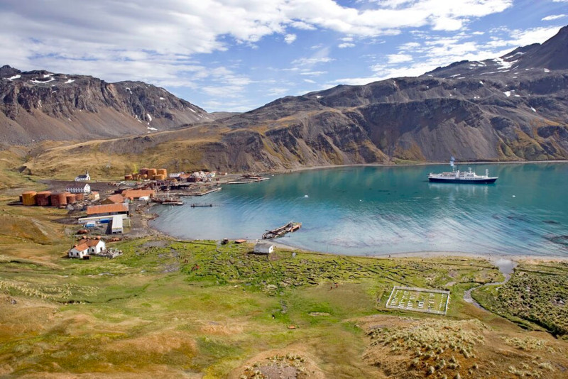
- Though it seems that no Indigenous Peoples ever inhabited the location, modern man’s maintained a small presence there. Historically, sealers and whalers made use of it as a base for their operations in the area. The little-visited South Georgia Museum still exists there today.
Related Articles
South Georgia Island Physical Description
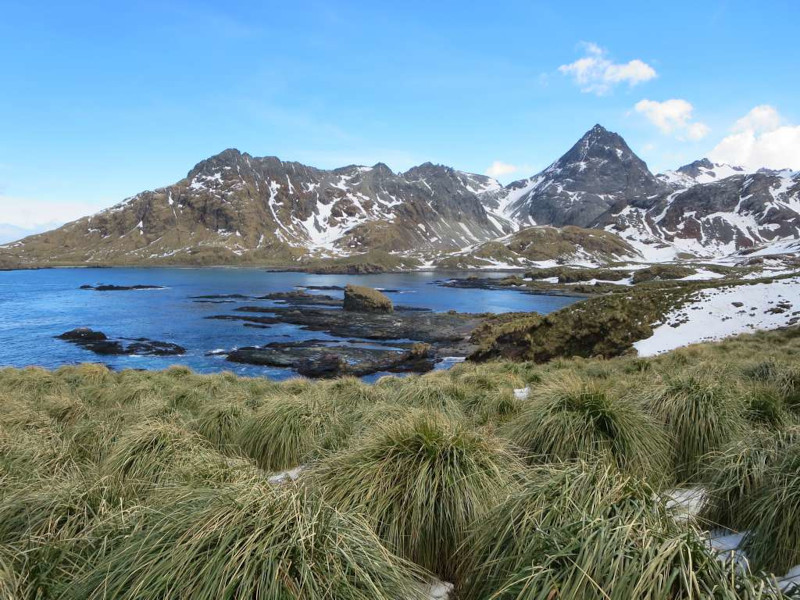
While not often visited, the rugged South Georgia Island holds an appeal of its own that usually captivates those fortunate few who visit it. That’s because, despite its remote location, it boasts a number of individual features to delight the eye and impress the mind of those lucky visitors.
The sheer physical dimensions of this rarely-seen creation of Nature typically represents the first characteristic to amaze those discover it. That’s true since it displays a roughly rectangular shape, with the remarkable formation stretching for approximately 103 mi (165 km) in total length.
Its width, however, is an interesting counterpoint to this statistic. This dimension of the member of its group varies a surprising amount across its length. At its widest point, this equals roughly 23 mi (37 km). In some places, though, this narrows to as little as an astounding 0.87 mi (1.4 km).
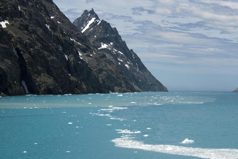
A series of high, rugged mountains dominate the landscape of this marvelous site. These run the length of the island in many locations. Several of these, in fact, reach over 9,500 ft (2,900 m) in height. Bearing the name Mount Paget, the tallest of these soars 9,626 ft (2,934 m) into the sky.
South Georgia also remains heavily glaciated. Incredibly, it’s covered with over 160 documented glaciers. Approximately half of the island’s covered by an impressive volume of permanent ice and snow. Augmenting its distinctiveness, many of these glaciers flow directly into the surrounding sea.
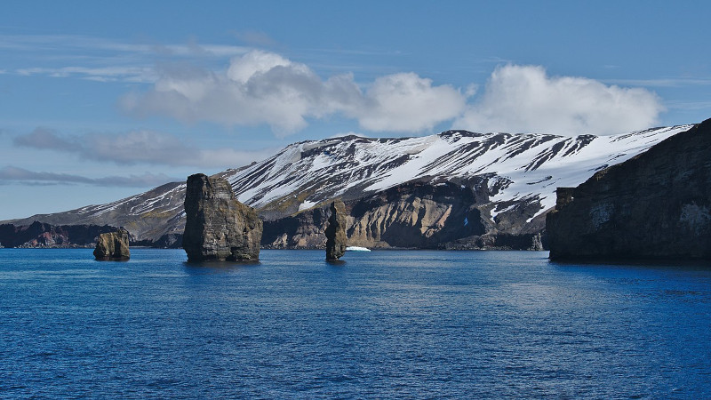
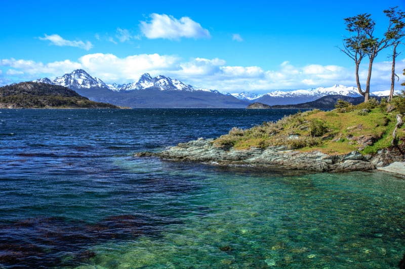
The coastline itself also formed as highly irregular, with steep cliffs, fjords, and deep inlets appearing in many locations. Many sheltered bays and coves additionally exist, scattered around the island. These include such individual wonders as the stunning King Edward Cove and Stromness Bay.
South Georgia Island Location, Formation, and Ecology
The mesmerizing South Georgia Island formed in a remote region of the surface of the earth. From looking at these images, though, few of you will be surprised at just where that location occurs. This amazing marvel of geology lies situated within a sub-region near what’s now Antarctica.
It’s located in the southern Atlantic Ocean, east of the southern tip of South America. Roughly 800 mi (1,300 km) away, the Falkland Islands represent its closest major landmass. It’s also placed about 1,340 mi (2,150 km) east of Cape Horn, in Chile, at the southern tip of South America.
This remarkable site formed as the result of complex geological processes tied to the movement of tectonic plates and the collision of the South American and Antarctic plates. Today, the gorgeous island’s located near the boundary between the South American Plate and the Scotia Plate.
Around 200 million years ago, during the breakup of the supercontinent Gondwana, the South American, African, and Antarctic plates began to drift apart. The island formed as a result of the subduction and collision of these plates, creating a predominantly mountainous and folded region.
It’s mainly formed of sedimentary rocks, like shale, formed from ancient seabed sediments that compressed and uplifted during the collisions. Metamorphic rocks also appear, created when the original rock formations were subjected to high pressure and heat during the tectonic processes.
Not surprisingly, most of South Georgia Island remains barren rock and ice. Nevertheless, Nature found a way for life to manage here. The lower slopes and coastal areas evolved moderate quantities of differing tundra-like vegetation, including various species of mosses, lichens, and small grasses.
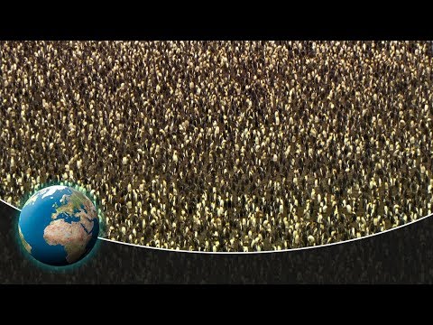
It’s also home to a rich variety of wildlife, especially seabirds and marine mammals. That includes large colonies of penguins, albatrosses, and petrels, who breed on the island. An impressive number of elephant seals, fur seals, and whales also continue to be common around the island.
Features Sharing Its Region
Check out our other articles on 7 Fascinating Fungi of North America, Clouded Leopard, Perito Moreno Glacier, New South Wales Waratah, California Mantis, Weka, American Alligator