CCL: https://bit.ly/3mf3iDN
It’s our sincere hope that each of you, our readers, will truly enjoy and appreciate this article we present about these 4 Incredible Islands of Antarctica. It was certainly our great pleasure to gather the various information for you. May it provide you with both education and increased awareness.
Certainly, these few sites listed herein, while wondrous, nonetheless represent only a small portion of the wonders found throughout this amazing region. It’s our belief, though, that they serve as excellent representations of the marvels found here. Check out some of our other articles, as well.
Alexander Island
CCL: https://tinyurl.com/2s4apsss
Alexander Island Facts
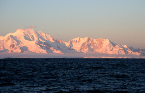
- Starting off this article about these 4 Incredible Islands of Antarctica we present you with the remarkable location named Alexander Island.
- The title used herein serves as the most frequently employed name for this extremely isolated and remote geological formation. It does have several other general titles, though. These other terms include the very similar monikers of Alexander I Land and Alexander I Island.
- This stunning creation of natural processes stands out in the annals of science for several remarkable reasons. It ranks as the largest island in its entire region of the globe, for one. The natural wonder’s also the second-largest uninhabited island in the world, as well.
- No archaeological evidence exists to indicate that any ancient humans ever knew of the existence of this site. The first known sighting of it only occurred on January 28, 1821. A Russian expedition, led by Fabian Gottlieb von Bellingshausen, accomplished the discovery.
- At the time, however, the group mistakenly believed it to be part of the mainland, due to its great size and extensive ice cover. This misidentification persisted until further exploration revealed its actual nature. A true identification only occurred in the 20th century.
- Several countries subsequently attempted to claim the amazing site following its discovery. The United Kingdom did so, in 1908. Chile later made the same attempt in 1940, followed by Argentina in 1942. The international Antarctic Treaty, however, recognizes no claim.
- Currently, the intriguing Alexander island enjoys a relatively high degree of protection from the many depredations of man. That’s because it’s covered under that same international treaty designed to monitor and preserve such amazing locations for the benefit of all mankind.
Alexander Island Physical Description
Though rarely seen due to its extremely remote location, the incredible Alexander Island never fails to capture to the attention of those few who do venture to its region. It does so for a wide variety of reasons, of course, but its sheer size alone understandably stands high among those factors.
Though highly irregular in outline, the magnificent geological structure possesses a generally rectangular overall shape. The island also measures about 240 mi (390 km) in length and 50 (80 km) in average width. The island’s total area further equals approximately 18,946 sq mi (49,070).
Along its exterior boundaries, the remarkable island additionally displays a very rugged and indented coastline with numerous inlets and fjords. Moving further inland, however, even more wonders await the visitor. Their variety increases to a very surprising degree, as well.
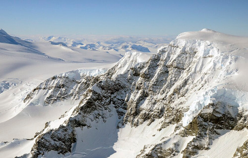
The site also formed as impressively mountainous in nature. Numerous peaks dot its landscape. The highest of these, though, bears the name Mount Stephenson. It reaches an altitude of about 9,800 ft (2,987 m). The central part of the island remains dominated by the Douglas Range.
The breathtaking distinctiveness of Alexander Island doesn’t simply end there, however. Most of the large island’s also permanently covered by ice. Individually impressive structures, called ice shelves, given their specific nature, such as the George VI Ice Shelf, also border the mesmerizing island.
Further augmenting the otherwordly beauty and uniqueness of this location comes yet another fabulous wonder of Nature. Numerous glaciers also descend from the many inland mountains, flowing to the coastline, with some even later forming floating ice tongues out in the sea.
But not all of the features of this marvel of natural geological forces owe their visual appeal and scientific interest to purely cold-related factors. That’s because some smaller parts of the intriguing island also show tantalizing evidence of past volcanic activity that helped to shape the site.
Alexander Island Location, Formation, and Ecology
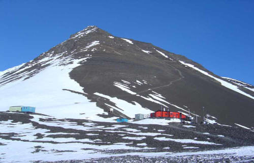
Nature created the truly mind-boggling Alexander Island in a highly remote region of the world already famous for its abundance of marvels. Given its ice-covered nature, though, that location probably won’t surprise many of you. Its situated within the boundaries of Antarctica.
There, its formation placed the marvel of Nature in what now bears the title of the Bellingshausen Sea. This formation itself lies roughly west of Palmer Land, which forms part of the Antarctic Peninsula. From that, though, it’s separated by both the Marguerite Bay and George VI Sound.
This incredible isle formed through a series geological and tectonic processes. Tectonic activity ranks high among these. Evidence additionally indicates that the site itself formed due to the subduction of oceanic crust beneath the continental crust of the Antarctic Peninsula.
Yet, the mysterious island also apparently had early volcanic origins, too. Significant evidence of volcanic rocks, such as andesite and basalt, exists in numerous scattered locations. Powerful volcanic eruptions apparently contributed to the formation of the island’s initial landmass.
Over countless millions of years, sedimentation also played a very significant role. Marine sediments accumulated on top of the volcanic base, further adding to the island’s geological structure. It was originally connected to the mainland, but later separated when a channel formed.
The harsh Antarctic climate, with its extensive glaciation, further significantly shaped this truly stunning product of geological forces. Large glaciers steadily eroded the landscape and deposited moraine and other glacial debris, strongly contributing to the island’s current topography.
Given the harshness of its environment, life understandably remains relatively scarce on Alexander Island, except within the surrounding waters. Scarce, however, does not mean absent. A limited number of species of flora and fauna do manage to survive here, creating a unique ecology.
Mosses and lichens comprise the primary forms of flora, typically situated in ice-free coastal areas and rocky outcrops. There, they tolerate the freezing temperatures and limited nutrient availability. Microalgae also live inside of meltwater pools and even on the surface of snow and ice.
Numerous seabirds such as skuas, petrels, and various species of penguins also frequent the island. These species obviously rely on the surrounding sea for food, and mainly use the site for breeding purposes. The terrestrial invertebrate fauna’s limited, but includes mites and springtails.
Deception Island
CCL: https://bit.ly/3mf3iDN
Deception Island Facts
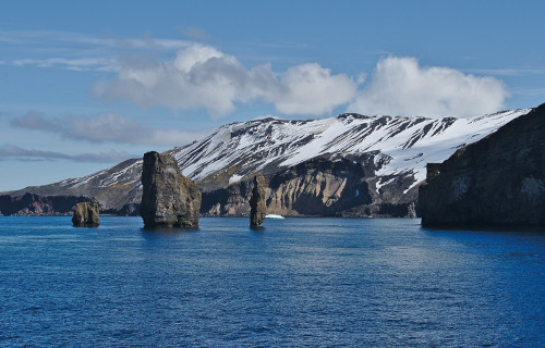
- Next up in this compilation of 4 Incredible Islands of Antarctica comes the stunning work of Nature bearing the name of Deception Island.
- The unusual title given to it serves well as the name of this fascinating creation of time and geological forces. That term speaks to the apparent safety provided by what seems to be a relatively safe harbor. That’s not always the case, though, thus the common title.
- This spectacular work of Nature actually forms the caldera of an active volcano! The intermittent activity of that occasionally creates havoc at the site. In 1967 and 1969, such activity severely damaged local scientific stations. It once held a whaling station, but no longer.
- It’s also something of a source of ongoing confusion in international politics. That’s because the issue of who possesses control of the island remains unsettled. Over the years, various countries attempted to assert their rule. For the moment, no single state has prevailed.
- Due to the nature of its location, this natural marvel remained undiscovered by the outside world until 1820. In January of that year, two British sealers reported spotting it. The first person to visit it was an American sealer named Nathaniel Palmer, the following November.
- Currently, the remarkable Deception Island remains under the binding authority of an international agreement. That’s comprised of what’s known as the Antarctic Treaty System. That designation became official in the year 2005. It places the site in a most unusual situation.
- Despite the occasional dangers posed by its sporadic volcanic activity, the location still serves as something of a tourist destination. Over 15,000 individuals visit the site annually. Two countries, Argentina and Spain, also operate research stations there during the summer.

CCL: https://bit.ly/415du0h
Deception Island Physical Description
The extremely unusual Deception Island intrigues many of the people who learn of it. The site does this, however, due to several reasons, not just a single one. While it’s certainly no tropical getaway destination, the location nevertheless boasts its own brand of appeal for the curious visitor.
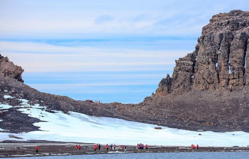
This intriguing wonder of Nature has a highly unique combination of patterns to its shape. While its outer boundaries aren’t perfectly so, it has an approximate circular yet horseshoe shape. At its widest point, the location also possesses a diameter measuring roughly 9.3 mi (15 km).
This wonder itself also contains two mountains of respectable heights, in relation to its size. On the eastern side, Mount Pond stands roughly 1,768 ft (539 m) above sea level. Meanwhile, on the western portion of the island sits Mount Kirkwood. Its height measures approximately 1,483 ft (452 m).
Amazingly, the site holds yet more wonders. That’s due to the remarkable fact that just over half of the area of the island remains covered by glaciers. These are almost 33 ft (10m) thick in some places. The same sections of the formation also contains ice covered pyroclasts and moraines.
Yet it’s perhaps the central portion of Deception Island that draws the most attention from its occasional visitor. That’s due to the fact that the sea flooded the section long ago. The region now represents a relatively large, open bay. This part of the site bears the name of Port Foster.
This feature itself holds bragging rights to some impressive statistics. It’s roughly 6.2 mi (10 km) in length, and 4.3 mi (7 km) in width. Yet it has a very narrow entrance that’s only 1,640 ft (500 m) wide. This feature itself also holds a distinctive name, in this case that of Neptune’s Bellows.
CCL: https://bit.ly/3KBSVDf
Deception Island Location, Formation, and Ecosystem
The remarkable Deception Island formed in a region of the world well known for its extraordinary abundance of stark beauty. That’s because this marvel of geological processes formed within the area of the globe known as Antarctica. That makes it an extremely remote location, indeed.
This fabulous volcanic formation further comprises part of the group of natural bodies collectively named the South Shetland Islands. This places the island very close to the Antarctic Peninsula. Within that greater region, though, it sits completely within an area known as the Bransfield Strait.
This island itself, however, repesents only a very small part of the story. What we view as the site in truth is only the exposed part of an active shield volcano. That awesome feature itself measures 18.6 mi (30 km) in diameter. That’s a truly astounding claim to fame for this stunning natural site.
It also continues to remain unknown to geologists exactly when the volcano itself came into existence. Researchers do know, however, the general period when it acquired the form now known to us. The caldera apparently collapsed somewhere roughly between 10,300 – 5,980 years ago.
The intriguing Deception Island, as fully befits its name, contains a deceptively sucessful ecosystem. It actually holds several widely varying microclimates. As mentioned, large parts of its surface are covered by extensive glaciers. But areas near active areas, temperatures reach 104F (40C).
A number of hardy plant species nevertheless manage to survive on the island. In fact, its confines play host to the largest selection of rare plants in the Antarctic. BirdLife International designated part of the site as an Important Bird Area, due to the presence of a penguin breeding area.
Macquarie Island
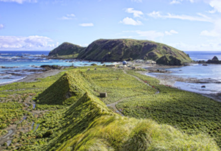
Photo: david takes photos
CC License: https://bit.ly/3tFiesK
Macquarie Island Facts
- Now appearing in this gathering of these 4 Incredible Islands of Antarctica comes the astonishing place known as Macquarie Island.
- This stunning isolated location most often bears the name we’re using. Though remote, it plays a vital role in the ecology of the region. That importance ranks as so great that it’s been named a UNESCO World Heritage Site. The location’s also a highly important research site.
- Despite that importance, however, the island remains almost entirely devoid of human life. The human presence on the island varies between 20 -40 individuals at any one time. That’s because only researchers temporarily based at the facilities there live on the island.
- The original base opened in 1911, under Douglas Mawson. Since then, it’s been under the jurisdiction of the Australian National Antarctic Research Expedition. The research facility draws its name from Lachlan Macquarie, a local figure in the early 19th century.
- The first known sighting of this marvel of geology occurred in the year 1810. At that time, an Australian sealer named Frederick Hasselborough spotted it. Evidence, however, indicates that ancient mariners knew of it, since he also spotted the remains of an ancient wreck.
- The original facility now bears the appropriate name of the Macquarie Island Station. There, the scientists conduct research in several important areas. These include, biology, meteorology, and human environmental impact, and perhaps most importantly, geosciences.
- In the intricate field of geoscience, stunning Macquarie Island offers an unparalleled opportunity to scientists. That’s due to a surprising statistic. This amazing site actually forms the only known spot where rocks from the earth’s mantle are actively exposed above sea-level.
Macquarie Island Physical Description
hough the wonder of Nature and geology known to man as Macquarie Island almost immediately captures the attention of anyone visiting it, the site does not do so due to its physical dimensions. That’s true given the simple fact that Nature packed its many marvels into a smaller package.
The attention-grabbing site measures approximately 21 mi (34 km) in length and 2 mi (3.2 km) in width. Overall, that gives the island a total area equaling roughly 47 sq mi (123 sq km). Further distinguishing it, the remote formation additionally possesses a highly elongated general shape.
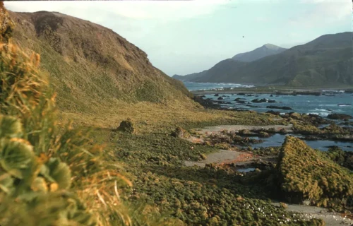
The majority of the amazing island has a generally flattened structure to it. The overall elevation of the marvelous spot merely measures roughly 800 ft (240 m). This altitude does, of course, vary in some random places. Distinctively, this holds true right up to the shoreline in most places.
This ancient marvel of geology isn’t entirely flat, however. That’s because the beautiful site does hold a certain number of moderately elevated locations. Some individual hills, highly rounded in nature, do appear. These rise to heights of as much as 1,200 – 1,400 ft (365 – 425 m).
At the shoreline, however, this situation changes extremely rapidly. That’s because the coast of Macquarie Island drops off precipitously in throughout most regions. But its many wonders don’t simply stop there. Impressively, even a few small glacial lakes dot the island in various locations.
CCL: https://bit.ly/311xBzu
Macquarie Island Location, Formation, and Ecosystem
The remarkable Macquarie Island formed in an undeniably remote corner of the globe. More precisely, it lies within the confines of a sub-antarctic region of the Southern Ocean. Its exact coordinates place the island almost precisely between the continents of Australia and Antarctica.
The landmass boasts an utterly unique geological situation, due to its nature. It actually represents only a tiny part of a much larger structure. That’s the similarly-named Macquarie Ridge. That’s an undersea formation, pushed into its location through the actions of tectonic plates.
The island itself represents only the exposed crest of this much larger structure. The base of the astounding formation actually lies far below the waves. This lies at a depth of roughly 3.7 mi (6 km) beneath the surface of the ocean. This mainly, though not just solely, consists of basalt.
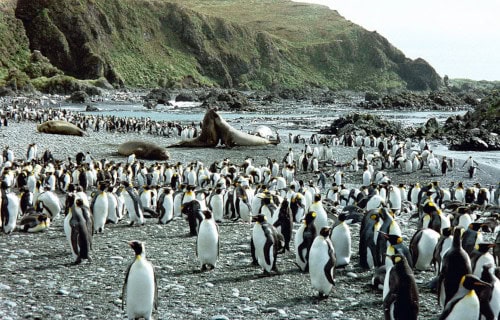
The majesty and importance of Macquarie Island dos not simply stop there, though. It’s also a highly important site for both flora and fauna. A total of at least 25 different known species of birds use it for breeding purposes. For some of those, in fact, it’s the only site they use for that.
Among the most notable avians breeding in this spot are albatrosses and petrels. The most noted, though, consists of the awesome royal penguin. This location currently represents the only known breeding site for that species in the entire world. It also holds a small colony of fur seals.
Its selection of native flora, though, remains somewhat smaller in size. For one, no native tree species appear on the site. It does boast other types of vegetation, though. These mainly include various grasses and mosses. The most remarkable exception to that is a native orchid.
South Georgia Island
CCL: https://tinyurl.com/22y23f9m
South Georgia Island Facts
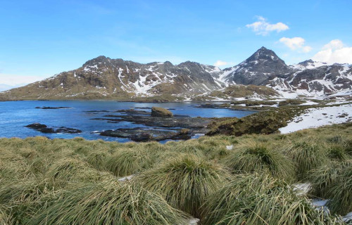
- Finishing up this compendium of 4 Incredible Islands of Antarctica we present you the captivating site named South Georgia Island.
- Today, this starkly beautiful creation of time and geological forces most frequently goes by the common name that we’ve applied to it. It does have a few other general titles, though. These include such tags as San Pedro Island, Isla Georgia del Sur, and Isle of Georgia.
- Yet, the marvel of Nature’s had even more designations throughout the centuries. Historically, some whalers and sealers also referred to the island by informal or colloquial names in their logs. These different eptihets, however, remain significantly less commonly known today.
- To date, no archaeological evidence exists to indicate that ancient man ever knew of its existence. Credit for its discovery in modern times, though, continues to be a complicated and contentious issue. That’s due to a dearth of reliable records by explorers during the period.
- The first recorded sighting of the intriguing island occurred on January 17, 1775. At that time, the British explorer Captain James Cook and his crew sighted the island during his second voyage to the southern Pacific. He then named it Isle of Georgia in honor of King George III.
- Some experts, however, believe the honor of the discovery of South Georgia Island belongs to Gregorio Jerez and his crew. He and the men of his ship, the Leon, potentially sighted the island in 1756. The feature they encountered, they eventually named San Pedro Island.
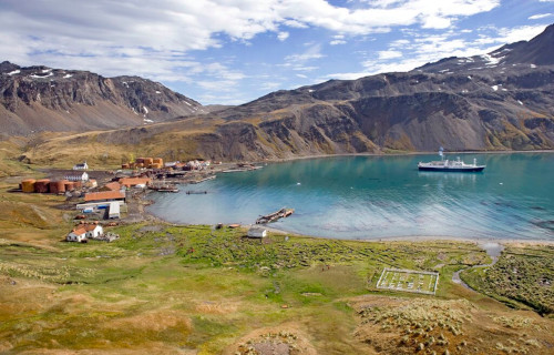
- Though it seems that no Indigenous Peoples ever inhabited the location, modern man’s maintained a small presence there. Historically, sealers and whalers made use of it as a base for their operations in the area. The little-visited South Georgia Museum still exists there today.
CCL: https://tinyurl.com/33psz7af
South Georgia Island Physical Description
While not often visited, the rugged South Georgia Island holds an appeal of its own that usually captivates those fortunate few who visit it. That’s because, despite its remote location, it boasts a number of individual features to delight the eye and impress the mind of those lucky visitors.
The sheer physical dimensions of this rarely-seen creation of Nature typically represents the first characteristic to amaze those discover it. That’s true since it displays a roughly rectangular shape, with the remarkable formation stretching for approximately 103 mi (165 km) in total length.
Its width, however, is an interesting counterpoint to this statistic. This dimension of the member of its group varies a surprising amount across its length. At its widest point, this equals roughly 23 mi (37 km). In some places, though, this narrows to as little as an astounding 0.87 mi (1.4 km).
A series of high, rugged mountains dominate the landscape of this marvelous site. These run the length of the island in many locations. Several of these, in fact, reach over 9,500 ft (2,900 m) in height. Bearing the name Mount Paget, the tallest of these soars 9,626 ft (2,934 m) into the sky.
South Georgia also remains heavily glaciated. Incredibly, it’s covered with over 160 documented glaciers. Approximately half of the island’s covered by an impressive volume of permanent ice and snow. Augmenting its distinctiveness, many of these glaciers flow directly into the surrounding sea.
The coastline itself also formed as highly irregular, with steep cliffs, fjords, and deep inlets appearing in many locations. Many sheltered bays and coves additionally exist, scattered around the island. These include such individual wonders as the stunning King Edward Cove and Stromness Bay.
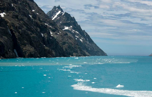
Photo: Christopher Michel
CCL: https://tinyurl.com/3ywffcfy
South Georgia Island Location, Formation, and Ecology
The mesmerizing South Georgia Island formed in a remote region of the surface of the earth. From looking at these images, though, few of you will be surprised at just where that location occurs. This amazing marvel of geology lies situated within a sub-region near what’s now Antarctica.
It’s located in the southern Atlantic Ocean, east of the southern tip of South America. Roughly 800 mi (1,300 km) away, the Falkland Islands represent its closest major landmass. It’s also placed about 1,340 mi (2,150 km) east of Cape Horn, in Chile, at the southern tip of South America.
This remarkable site formed as the result of complex geological processes tied to the movement of tectonic plates and the collision of the South American and Antarctic plates. Today, the gorgeous island’s located near the boundary between the South American Plate and the Scotia Plate.
Around 200 million years ago, during the breakup of the supercontinent Gondwana, the South American, African, and Antarctic plates began to drift apart. The island formed as a result of the subduction and collision of these plates, creating a predominantly mountainous and folded region.
It’s mainly formed of sedimentary rocks, like shale, formed from ancient seabed sediments that compressed and uplifted during the collisions. Metamorphic rocks also appear, created when the original rock formations were subjected to high pressure and heat during the tectonic processes.
Not surprisingly, most of South Georgia Island remains barren rock and ice. Nevertheless, Nature found a way for life to manage here. The lower slopes and coastal areas evolved moderate quantities of differing tundra-like vegetation, including various species of mosses, lichens, and small grasses.
It’s also home to a rich variety of wildlife, especially seabirds and marine mammals. That includes large colonies of penguins, albatrosses, and petrels, who breed on the island. An impressive number of elephant seals, fur seals, and whales also continue to be common around the island.
CCL: https://bit.ly/415du0h
4 Incredible Islands of Antarctica
We hope that each of you thoroughly enjoyed reading, and hopefully learning something from, this article we’ve written about these 4 Incredible Islands of Antarctica. It’s also our hope that doing so has left you with either a new or renewed appreciation for such amazing wonders of Nature.
Unfortunately, many other such features located around the world now find themselves facing severe threats to their continued existence in an undamaged state. Many of those dangers, in fact, stem from the actions of mankind. We must do all we can to protect and preserve them all.
Check out our other articles on 5 Amazing African Herbaceous Plants, Earth’s 7 Mightiest Rivers, 4 Fabulous Geological Features of Texas, Spectacular Dolphins Throughout Our World










Leave a Reply