

Bali Facts
- Bali names an island and province of Indonesia, Asia, and also includes a few smaller neighboring islands, notably Nusa Penida.
- The island sits at the westernmost end of the Lesser Sunda Islands. Further, it lies between Java to the west and Lombok to the east.
- Bali also forms part of the Coral Triangle, the area with the highest biodiversity of marine species. For example, in this area alone over 500 reef-building coral species exist.
- For comparison, this equals about 7 times as many as in the entire Caribbean.
- There also exists a wide range of dive sites with high-quality reefs. All of these boast their own specific attractions. Many sites often have strong currents and swells so scuba diving without a knowledgeable guide remains inadvisable.
Related Articles
Bali Geographical Location and Description
The island of Bali sits about 8 degrees south of the equator. It and Java remain separated by the Bali Strait, roughly 95 mi (153 km) in length and 69 mi (112 km) in width.
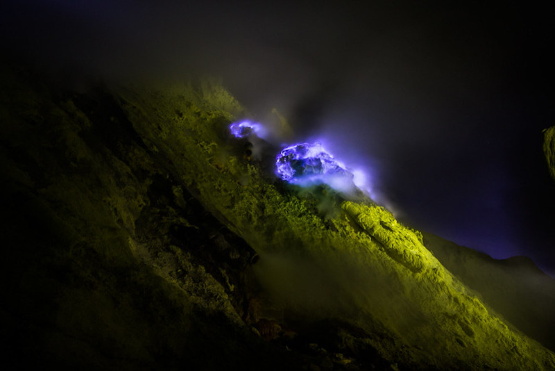
Its central mountains include several peaks over 9,842 ft (3,000 m) in height. The highest is Mount Agung, known as the mother mountain, an active volcano.
The volcanic nature of the geology of Bali also contributed to its exceptional fertility. Additionally, its tall mountain ranges provide the high rainfall that supports the highly productive agriculture sector.
Bali Landscape
The northern side of the mountains slopes more steeply to the sea and holds the main coffee producing area of the island, along with rice, vegetables, and cattle. The island also continues to be surrounded by coral reefs.
Beaches in the south tend to have white sand while those in the north and west have sand colored black. The island has no major waterways, although the Ho River is navigable by small sampan boats.
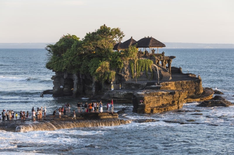
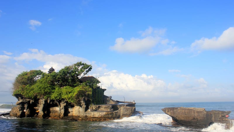
Black sand beaches between Pasut and Klatingdukuh are under development for tourism, but apart from the seaside temple of Tanah Lot, they are not yet in use for significant tourism.
![Bali, Indonesia [Amazing Places 4K]](https://i.ytimg.com/vi/2b9txcAt4e0/hqdefault.jpg)
Features Sharing Its Region
Check out our other articles on 5 Amazing Fungi of Asia, North Atlantic Right Whale, Deception Island, Tree Bumblebee, Great Potoo, Rose’s Ghost Frog, Weka, Hermann’s Tortoise