


Public Domain Image
Prince Edward Island Facts
- The breathtakingly beautiful location known as Prince Edward Island ranks as a geological marvel. This occurs due to its sheer natural beauty. But it also remains renowned for its lush agricultural land, as well as its great swathes of pastoral land.
- The truly magnificent island further stands out for another reason. In point of fact, it represents one of the oldest settlements in the country. The remarkable location bears the name of Prince Edward (1767-1820), the father of Queen Victoria.
- Quite unsurprisingly, agriculture forms the principal economy of the island. This amazing island therefore further plays an important economical role. It alone produces roughly 25% of all potatoes grown in the country it forms a part of.
- Finally, the stunning Prince Edward Island also serves as an important location for numerous other industries. Not surprisingly, these include tourism, fishing, aerospace, bio-science, and especially renewable energy research and development.
Related Articles


Kiawah Island Mount Desert Island Avery Island

Prince Edward Island Geology
The province of which Prince Edward Island forms the central component comprises numerous separate parts. That’s due to a comparatively unusual situation for its parent country. That’s the fact that it consists of a main island and 231 minor constituent islands.
Altogether this grouping comprises a moderately impressive total area. More precisely, this combination of sites achieves a total land area measuring about 2,195 sq mi (5,685 sq km). The main island itself, though, measures roughly 2,170 sq mi (5,620 sq km).
The gorgeous Prince Edward Island formed between 250-300 million years ago, occurring during the Permian period. Freshwater streams deposited enormous quantities of gravel, sand, and silt into the region now popular as the Gulf of Saint Lawrence.
Much of the bedrock of the island also principally consists of the distinctive mineral red sandstone. Prior to the enormous glacial melting which occurred during the last ice age, the island was connected to the mainland by a small strip of land.

Prince Edward Island Geography
The truly magnificent Prince Edward Island sits in an area of the world already known for its great beauty. That’s due to the fact that it formed north of the Nova Scotia Peninsula. More precisely, it resides within what’s now known as the Gulf of Saint Lawrence.
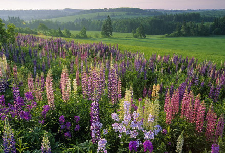
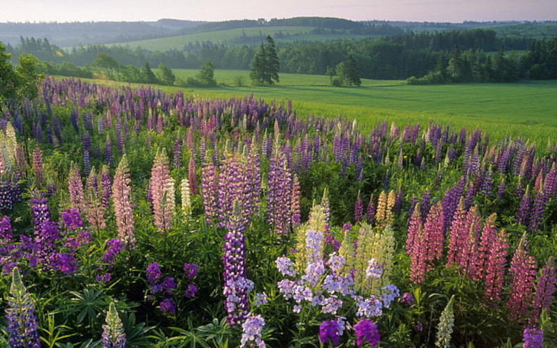
The general landscape of the impressive main island remains primarily pastoral. It’s also quite famous for the unique combination of thickly wooded regions, gently rolling hills, beaches of reddish-white sand, numerous coves, and the ever-present red soil.
Also, present along the shoreline are saltwater marshes and red sandstone cliffs. The northern shore of Prince Edward Island holds numerous dune fields. In Basin Head cape, the properties of the white silica sand actually generate a singing sound when walked on.
Public Domain Image
Prince Edward Island Location and Climate
Surprisingly, Prince Edward Island and its associated numerous small islands and islets comprise one of the provinces of Canada, in North America. Despite its location, however, in general, the local climate remains relatively mild for its latitudinal position.
More precisely, though, during the months of July and August, the usual high temperature is 73 F (23 C). Yet it occasionally experiences highs of as much as 86 F (30 C). Conversely, however, during the coldest months of winter, the average highs are 26 F (-3 C).
Prince Edward Island receives an annual rainfall of 33.7 in (855 mm), as well as a yearly snowfall average of roughly 11.2 in (285 cm). Spring storms are plentiful, due to the constant clash between weather fronts from both the Arctic and the Atlantic weather patterns.

Features Sharing Its Region
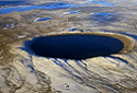
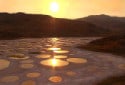
Carcross Desert Pingualuit Crater Lake Spotted Lake
Check out our other articles on 5 Spellbinding Scorpions, Snowy Owl, Gates of Hell, Jade Vine, Olive Ridley Sea Turtle, Goliath Stick Insect, Black Rain Frog, West Indian Manatee