


Waw an Namus Facts
- The astounding volcano known as Waw an Namus truly distinguishes itself from other, relatively ordinary volcanoes. The name of the magnificent site also has an alternate spelling, however. By either name, though, this marvel remains a breathtaking sight to behold.
- Surprisingly enough, the English translation of the original name of this wonder roughly equals Oasis of mosquitoes. The exact age of the formation also remains a point of controversy among scientists. Different pieces of evidence hint at varying ages for this work of Nature.
- The natives of the region it appears in knew of the existence of this masterpiece for many centuries, prior to its discovery by outsiders. The first mention of it to the rest of the world, howver, occurred in 1862. The German explorer Karl Moritz von Beurmann made that report.
- The first known outsider to reach it, though, only did so in the year 1920. At that time, the French explorer Laurent Lapierre had that singular honor. The first known scientist to reach the volcano, did so in 1931. That distinction belongs to the Italian geologist, Ardito Desio.
- In our modern era, this creation of powerful natural forces now represents one of the most popular tourist destinations in its region. Those fortunate individuals enough to visit Waw an Namus quickly realize that it has far more to offer the observer than many other volcanoes.
Related Articles

Waw an Namus Physical Description
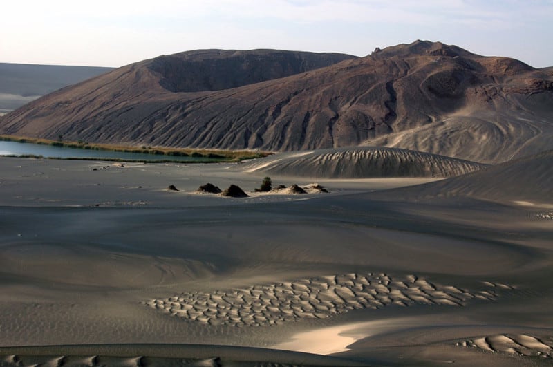
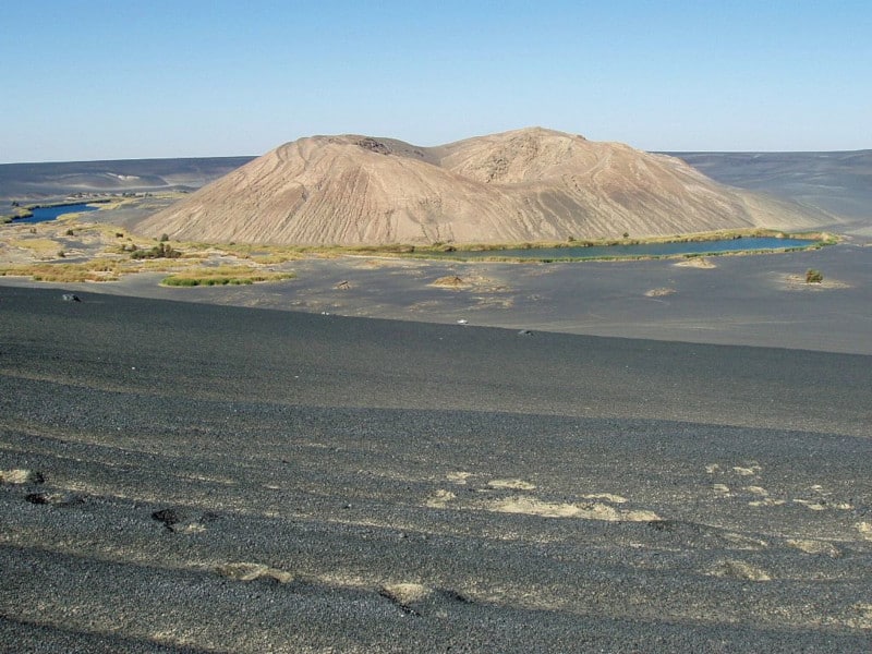
Despite not being its most notable feature, the sheer size of Waw an Namus quickly grabs the attention of visitors. That’s because the caldera itself measures a staggering 2.5 mi (4 km) in diameter. This same feature also boasts a depth measuring roughly 330 ft (100 m).
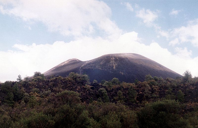
Nestled within the confines of the already remarkable caldera itself, though, lies an equally impressive scoria cone. This natural formation itself measures about 0.81 mi (1.3 km) wide at its base. This section of the volcano also has a height of approximately 460 ft (140 m).
Yet, amazingly, this feature holds still another crater! This particular one, though, happens to measure roughly 260 ft (80 m) deep, and 490 ft (150 m) wide. The remains of still another such is situated on the western section of the summit of the crater of the awesome Waw an Namus.
Its wonders do not simply end there, however. A darker colored layer of volcanic fragments also extends outward around the central site. This other layer, called tephra, reaches a mind-boggling distance of 12.4 mi (20 km) in some directions. Its depth also ranges from 0.8 – 59 in (2 – 150 cm).
Waw an Namus Location, History, and Ecosystem
The mesmerizing site known as Waw an Namus formed in a part of the world that may shock some individuals who learn of it. That’s because the marvel lies within the confines of the Sahara Desert! More specifically, it’s found in the Fezzan region of the country of Libya, set in Africa.
To this day, the exact age of the structure remains a source of debate among researchers. The latest studies place its formation at somewhere around 200,000 years ago, give or take about 9,000 years. The scoria cone situated in the center, though, may be only a few thousand years old.
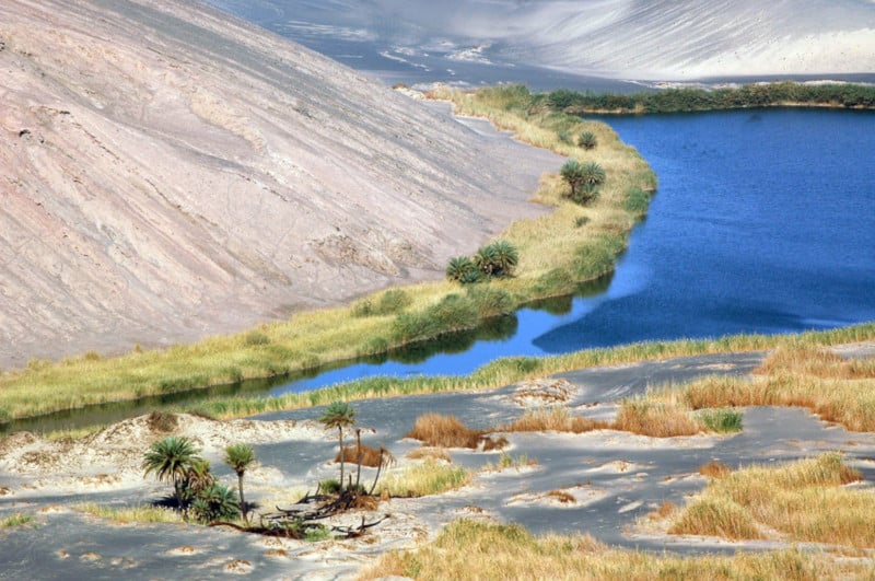
Incredibly, a stunning total of three small lakes actually lie within the caldera of Waw an Namus. Given the fact that evaporation rates in the region exceed precipitation rates, experts believe that they’re fed by groundwater. These have a total surface area of around 0.12 sq mi (0.3 sq km).
These remarkable, and unexpected, lakes remain relatively shallow, however. In fact, the maximum depth of the deepest only reaches 49 – 52 ft (15 – 16 m). Seasonal variations affect the altitude of these bodies of water, as well. Nonetheless, this averages roughly 1,424 ft (434 m) above sea level.
Various other small bodies of water also appear within Waw an Namus. These, however, tend to come and go at random intervals. All of them sometimes display various shades of red. To no surprise, however, the colors derive from chemical compounds in the surrounding rock strata.

Features Sharing Its Range
Check out our other articles on 4 Amazing New Guinea Species, Rusty-Spotted Cat, McMurdo Dry Valleys, Arrowleaf Elephant Ear, Salt Creek Tiger Beetle, Bowmouth Guitarfish, Black Caiman