Lagoa do Fogo Facts
- The term of Lagoa do Fogo serves as the most frequently used name for this remarkable creation of geological processes. The formation also has another title it’s known by, though. That’s because it also holds the less-often used name Lake of Fire.
- The major credit for the discovery of this majestic site in more modern times typically goes to Portuguese explorers. Records show that they first encountered the location in 1427. That occured during the heyday of European exploration of the world.
- Scientific evidence does now exist that indicates others found it earlier, however. These discoveries clearly show, in the minds of many researchers, that ancient Viking explorers visited it as much as 700 years prior to the arrival of the Portuguese sailors.
- Neighboring islands, though, show indications of human presence going back even further. That suggests the possibility of their visiting Lagoa do Fogo. Their identity is unknown, but signs of a human presence in the area date back almost 2,000 years.
- Thankfully, today the magnificent location enjoys a certain amount of legal protection from the depradations of man. National legislation designated the lake as a protected area in 1974. That same action formed the Reserva da Lagoa do Fogo.
Related Articles
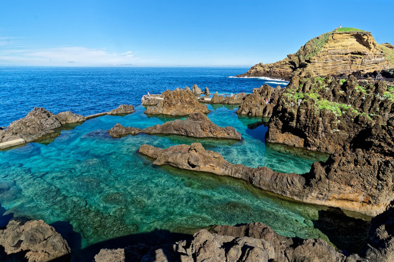
Lagoa do Fogo Physical Description
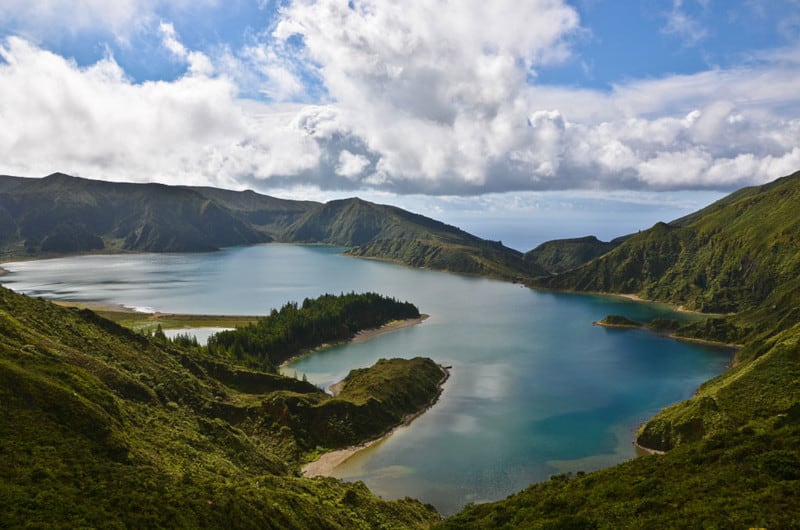
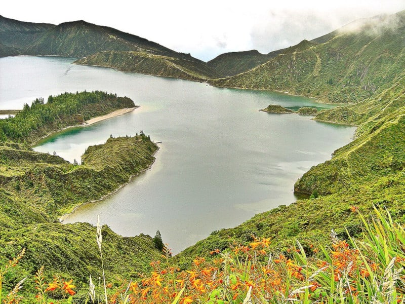
The stunning Lagoa do Fogo immediately captivates the vast majority of those fortunate enough to visit the site. Obviously, it principally does so due to its sheer natural beauty. Yet the gorgeous creation of Nature also garners appreciation for its geological nature.
Amazingly, the body of water lies within the caldera of an extinct stratovolcano, which in turn is also part of the Agua de Pau Massif. Though understandably highly irregular in its outline, the overall shape of the impressive body of water remains slightly rectangular.
At its greatest, the lake measures approximately 1.9 mi (3.0 km) in length. Its widest point, meanwhile, comes in at roughly 1.5 mi (2.4 km). Factoring in all its irregular dimensions, the remarkable water body possesses a total surface area equaling about 2.85 sq mi (4.56 sq km).
Yet the wonders of Lagoa do Fogo do not simply end there. That’s true due to the fact that Nature provided it with other marvels. In one location, deposits of sediment actually formed a small beach along the perimeter of the lake. It also boasts a depth of 98 ft (30 m).
Lagoa do Fogo Location, Formation, and Ecology
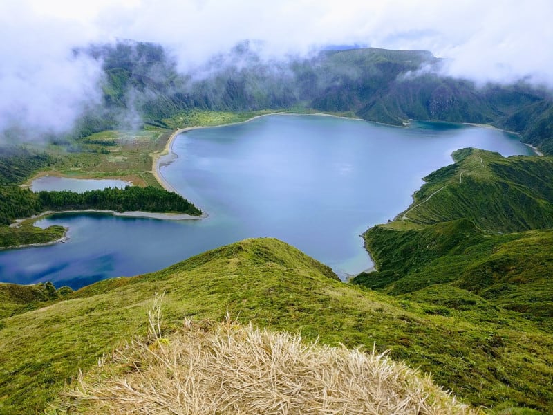
Majestic Lagoa do Fogo formed in a general region of the globe renowned for its abundance of natural wonders. The precise area of the globe may surprise some people, though. That’s due to the fact that it lies on an island situated in the north Atlantic Ocean.
That island, named São Miguel, forms part of the archipelago known as the Azores. Amazingly, though, it actualy lies within the crater of an ancient volcano. Geographically, both this structure and the dazzling lake itself sit in the immediate center of the island.
The caldera in which it sits obviously formed first. That occurred around 15,000 years ago. Subsequent to that, the top collapsed roughly 5,000 years ago. The last eruption of the parent volcano took place in 1563. It’s been quiet since, thus allowing the lake to form.
The water within the confines of the intriguing lake comes purely from the frequent, and occasionally torrential, rains common to the region. Over the centuries, Nature achieved a natural balance between evaporation and the influx of freshly deposited rainfall.
Lagoa do Fogo serves to support an important biome. The one the south and west side is a concentration of scrub and brush. But on the north and east side lies dense vegetation and a small forest. Numerous species of flora and fauna endemic only to the Azores live here.
A wide variety of bird species constitutes the primary animal life within the area. This includes both terrestrial species as well as seabirds. Impressively, for many of these avian species, the lake supports the largest breeding and habitat area in the entire region.
Features Sharing Its Region
Check out our other articles on Lost Lake, Great Salt Lake, Lake Nakuru, Spotted Lake, Homestead Caldera, Kelimutu, Bloody Hell Pond, 7 Truly Astounding Geological Wonders

Leave a Reply