Bay of Islands Facts
- Perhaps most notably, the aptly-named marvel of the Bay of Islands constitutes one of the most beautiful geological marvels of its region. This statement, an opinion shared by many individuals, occurs for a very specific and truly astounding reason.
- That’s because the sheer variety and scope of natural beauty found here easily ranks it as one of the most remarkable places on Earth. This principle extends to the natural geography of the location, in addition to the great biological beauty found there.
- That holds true due to one amazing fact. This one bay holds a phenomenal total of 144 separate and distinct islands within its boundaries. Due to the shape of the individual islands, many of them, amazingly, also possess their own peninsulas and inlets.
- The site has a long history of use. This holds true because the Maori originally colonized the islands in the bay roughly 700 years ago. The principal tribes involved in the colonization of the Bay of Islands consisted of the Ngapuhi iwi and the Ngati Miru.
- The discovery of the breathtaking Bay of Islands, by outsiders, though, occurred much later in history. In point of fact, the first known European to see the bay happened to be the famous James Cook. This fortuitous discovery occurred in the year 1769.
- This magnificent location also quickly garnered the interest of those looking to expand. It therefore represented the first site in the region to be settled by Europeans. Whalers arrived at the end of the 18th century, followed quickly by missionaries in 1814.
Related Articles
Bay of Islands Physical Description
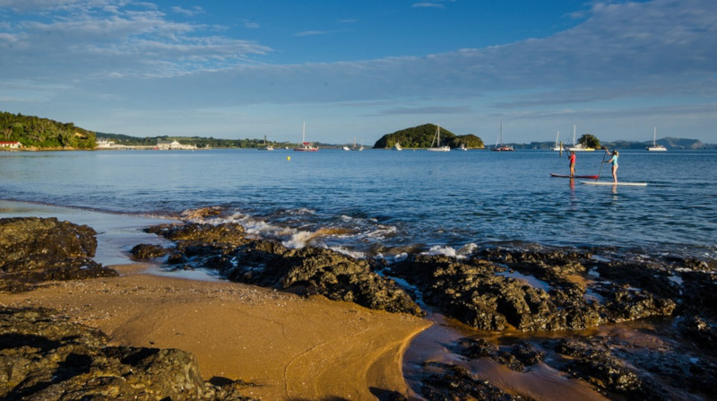
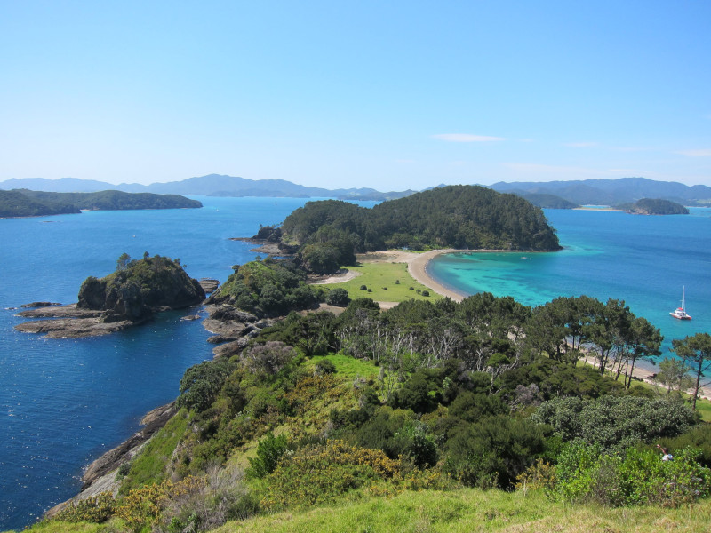
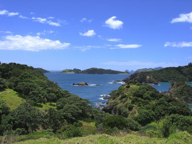
The stunning site appropriately known as the Bay of Islands consists of an irregular-shaped drowned valley system that also just happens to hold a natural harbor. The spot also covers a total area of approximately 100.4 sq mi (260 sq km) and holds a total of 144 islands.
The lovely islands of Kerikeri, Te Puna, and Waikare Inlet comprise the three largest islands in the bay. The breathtaking region also includes a vast number of smaller bodies and other formations. These include a number of naturally formed inlets and peninsulas.
The waters of the beautiful bay also hold yet another distinction. That’s because these rank as the second bluest in the world, according to many. The grandeur of the Bay of Islands, however, does not simply end there. Nature, it seems, had still more plans for the site.
This holds true due to the amazing fact that many of the islands also contain beaches formed of golden colored sand and an abundance of lush vegetation. The waters of the magnificent region additionally contain vast quantities of numerous species of marine life.
The beautiful bay is separated from the Pacific Ocean by the Purerua Peninsula and Cape Brett. The Purerua Peninsula also shields the northwestern section of the bay. Cape Brett shields the eastern side. This cape itself further extends 6.2 mi (10 km) into the ocean.
Bay of Islands Location, History, and Ecology
It bears mentioning that the magnificent feature known as the Bay of Islands formed in an area of the world already highly renowned for its breathtaking regions of natural beauty. That’s because it lies in what now represents the island country of New Zealand.
This most likely comes as no surprise to those familiar with the already incredible natural beauty for which this part of the world remains famous. Subsequent to its discovery by European explorers, numerous whalers and missionaries poured into the region.
This influx of non-indigenous people began around the year 1814, and rapidly grew to a flow of significant proportions. The region eventually became the site of the first permanent European settlement in the country. This original site bore the name of Russell.
Many original Maori settlements also played key roles in the development of the Bay of Islands, as well as the country. In fact, the community of Okiato became the first capital of New Zealand. This occurred due to the role it played in the early days of the region.
The location remains famous even today for its incredible beauty. Due to this, in fact, it has become a popular tourist destination. Due to enormous publicity provided in the 1930’s by author Zane Grey, the region also became quite famous for its big-game fishing.
However, the amazing region of the globe also serves as a popular destination for sailing enthusiasts and numerous other tourist activities. In more recent times, its great natural beauty has been featured in a number of major movies, serving as a stunning backdrop.
Features Sharing Its Region
Check out our other articles on Fabulous Herbaceous Plants Named After Animals, Gulper Eel, Belogradchik Rocks, Naked Man Orchid, Adelie Penguin, Achrioptera manga

Leave a Reply