Cango Caves Facts
- This breathtaking creation of natural processes goes by the english name of the Cango Caves. Perhaps the most noteworthy fact about this site is its sheer status. That’s due to the fact that it’s the most extensive geological feature of its kind in the region.
- Archaeological evidence indicates that prehistoric man also knew of this natural masterpiece. This includes cave paintings and stone artifacts. Many of these date back to the Middle and Late Stone Age. It likely served as a convenient shelter and refuge.
- It appears that local inhabitants of the region forgot about the caves after the Stone Age, however. The rediscovery of the site in modern times occurred in the year 1780. At that time, a local farmer named Jacobus Van Zyl fortuitously stumbled upon them.
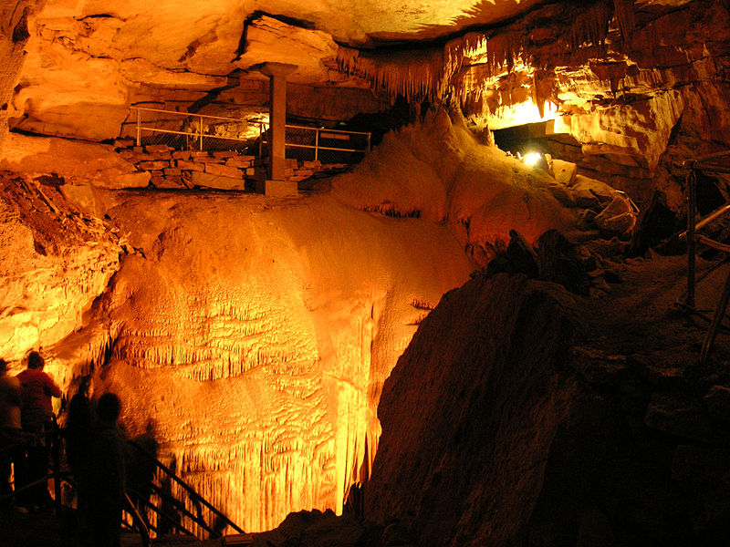
- The magnificent site remains one of the most popular tourist sites in the region. Despite this, tourists can only access approximately one-fourth of their extent. Those same tourists can only enter the complex as part of a supervised group, though.
- Exploration of the Cango Caves also remains ongoing. On multiple occasions since their discovery, these explorations added significant features and length to known aspects of the system. The municipality of Oudtshoorn currently manages the site.
Related Places
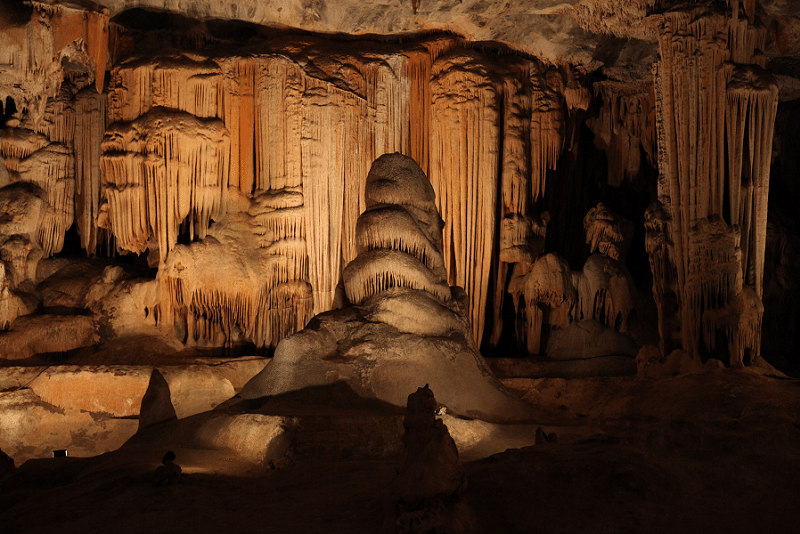 Source: http://bit.ly/2i7wTcZ Photo: Rute Martins CCL: https://bit.ly/3ya7W6o
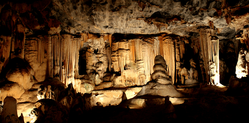
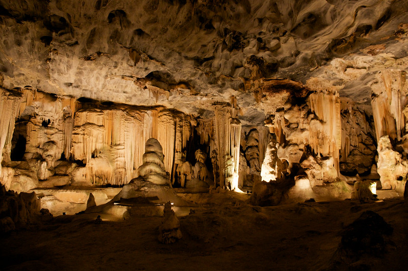
Cango Caves Physical Description
The remarkable Cango Caves stands out from many similar features around the world. It does so due to its pure nature. This awesome location boasts some impressive traits. These mainly consist of a series of extensive hidden chambers and connecting tunnels.
Although only a portion remains accessible by the public, the entire confirmed system extends for a respectable distance. Its presently known length measures approximately 2.5 mi (4 km). Indications hint at further features lying beyond this distance, however.
Numerous large chambers exist within its confines. Most of these remain connected by twisting tunnels containing marvelous sights and experiences. The natural chambers vary in size, of course. The largest currently known measures roughly 984 ft (300 m) in length.
An intriguing coincidental aspect of the cave system also exists within its depths. The deepest section of the complex also lies a distance beneath the surface equal to the length of the aforementioned chamber. It’s a remarkable example of naturally occurring symmetry.
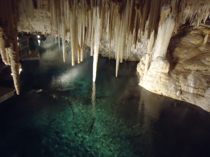
Thousands of visually impressive stalagmites and stalactites additionally fill the various chambers within the Cango Caves. The surrounding rock primarily consists of ancient limestone. A small underground river also flows through some of the chambers and tunnels.
Cango Caves Location, Formation, and Exploration
The magnificent Cango Caves formed in a region of the globe already renowned for its abundance of natural wonders. More precisely, it lies in what now constitutes the country of South Africa, in Africa. The nearest town presently sits about 10 mi (16 km) away.
Not surprisingly, given its extent, this complex of caves and tunnels also happens to be quite old. The limestone in which these appear formed during the Precambrian Period. Due to natural processes, the caves and tunnels formed an estimated 20 million years ago.
Like most similar features around the globe, research indicates that this complex formed quite slowly. Apparently, the system originally formed as a series of dripstone caverns. The site still lies in a limestone ridge running parallel to the intriguing Swartberg Mountains.
The first known attempt to formally map the expansive system occurred in 1897. This early effort mapped out a remarkable total of 26 chambers. Much later, the first scientific mapping of the complex was carried out by the South African Speleological Association, in 1956.
Subsequent efforts in 1972 artificially widened a passage to reveal yet another section. This area eventually became known as the equally impressive Cango 2. This section of the Cango Caves stretches a total of 890 ft (271 m). At its ends, however, a body of water existed.
Explorers later drained the water present in the chamber. Doing so thus exposed an obviously unknown passageway. Exploration of that, in turn, led to the discovery of another section, now known as Cango 3. Yet more chambers may lie beyond areas still under water.
Features Sharing Its Region
Check out our other articles on Earth’s Extremely Threatened Flowers, Tiger Rattlesnake, Bee Hummingbird, Enchanted Well, Chinese Giant Salamander, Eurasian Brown Bear

Leave a Reply